Incredibly, the most deadly path in Britain isn't atop a high peak in Scotland or Wales. Perhaps more incredibly, it's not even the fact that you have to walk through Ministry of Defence-owned land just to get to it that makes it deadly.
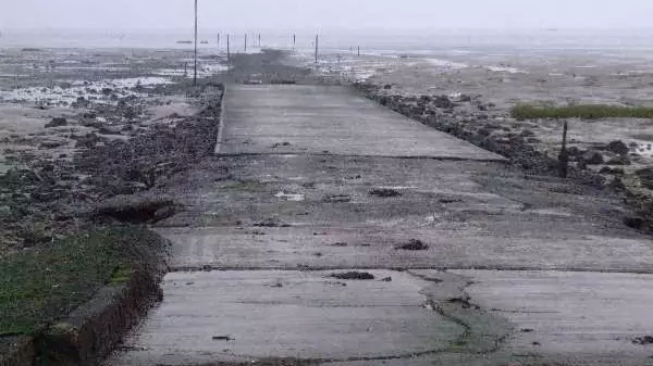
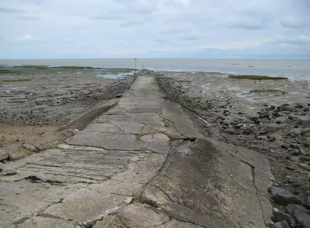
The Broomway is a sea path off the coast of Essex that connects the village of Great Wakering to Foulness Island, and is alleged to have claimed more than 100 lives.
Most of these bodies have been accounted for, with EssexLive reporting that 66 of the path's victims are said to be buried in the Little Foulness churchyard; however many more remain unaccounted for, presumably swept away by the tide.
Advert

The cause of most of the deaths is obvious. The Broomway itself takes around three hours to walk and is only accessible during low tide. That hasn't stopped people from thinking they can walk it more quickly and subsequently set off too late to attempt it.
In addition to the restricted access times, the route itself is barely visible given you're essentially walking across the sea bed - and so getting lost can be fatal.
The path is only mapped out with poles stuck into the ground - in fact, that's how the route got its name, due to the legend that they were brooms stuck upside down in the mud (some olden days legends are proper daft, eh?).
Advert
Oh, and did I mention that you have to access Ministry of Defence land to even get to the beginning of the path? It's recommended that would-be walkers call ahead of arrival to make sure they are able to gain access and, you know, won't accidentally get shot or anything.
If you don't get permission you'll be met with a closed gate and 'DANGER' signs. I presume you'd get them anyway though, unless they airlift the signs and gates in and out depending on when you're allowed to walk, which would be a big waste of MOD resources.
Until 1922 it was the only way to access Foulness Island other than by boat, when a bridge over nearby Havengore Creek was built. So why would you actually want to risk your life for this?
Advert
The author Robert Macfarlane covered the walk in his book The Old Ways, and he remembers it fondly, writing: "Half a mile offshore, walking on a silver water, we crossed a path that extended gracefully and without apparent end to our north and south."
He added: "Its bright line curved away from us: an ogee whose origin we could not explain and whose invitation to follow we could not disobey, so we walked it northwards, along that glowing track made neither of water nor of land, which led us further and further still out to sea."
I'll take that bridge instead thanks, Bob.
Featured Image Credit: GeographBot (Creative Commons)Topics: UK News, Interesting