
A filmmaker has captured amazing drone footage of a volcano erupting. Watch it here:
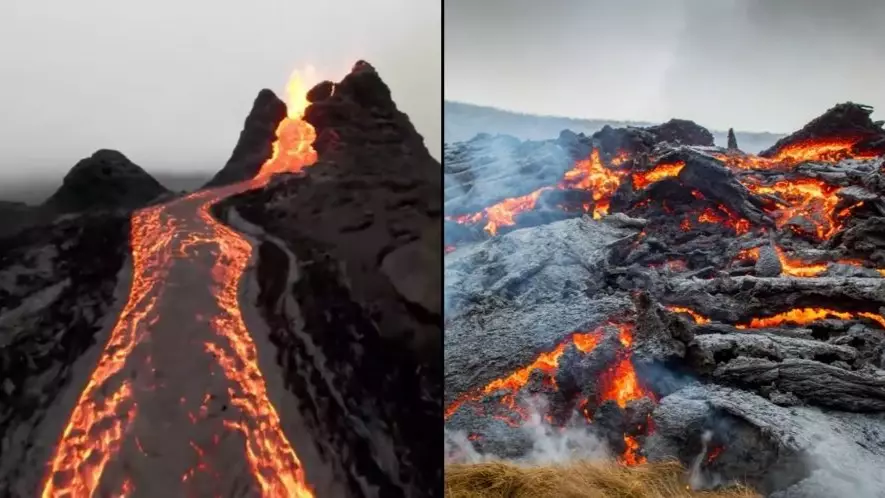
The volcano, known as Fagradalsfjall, erupted in the southwest of Iceland and was caught on video by Bjorn Seinbekk.
Advert
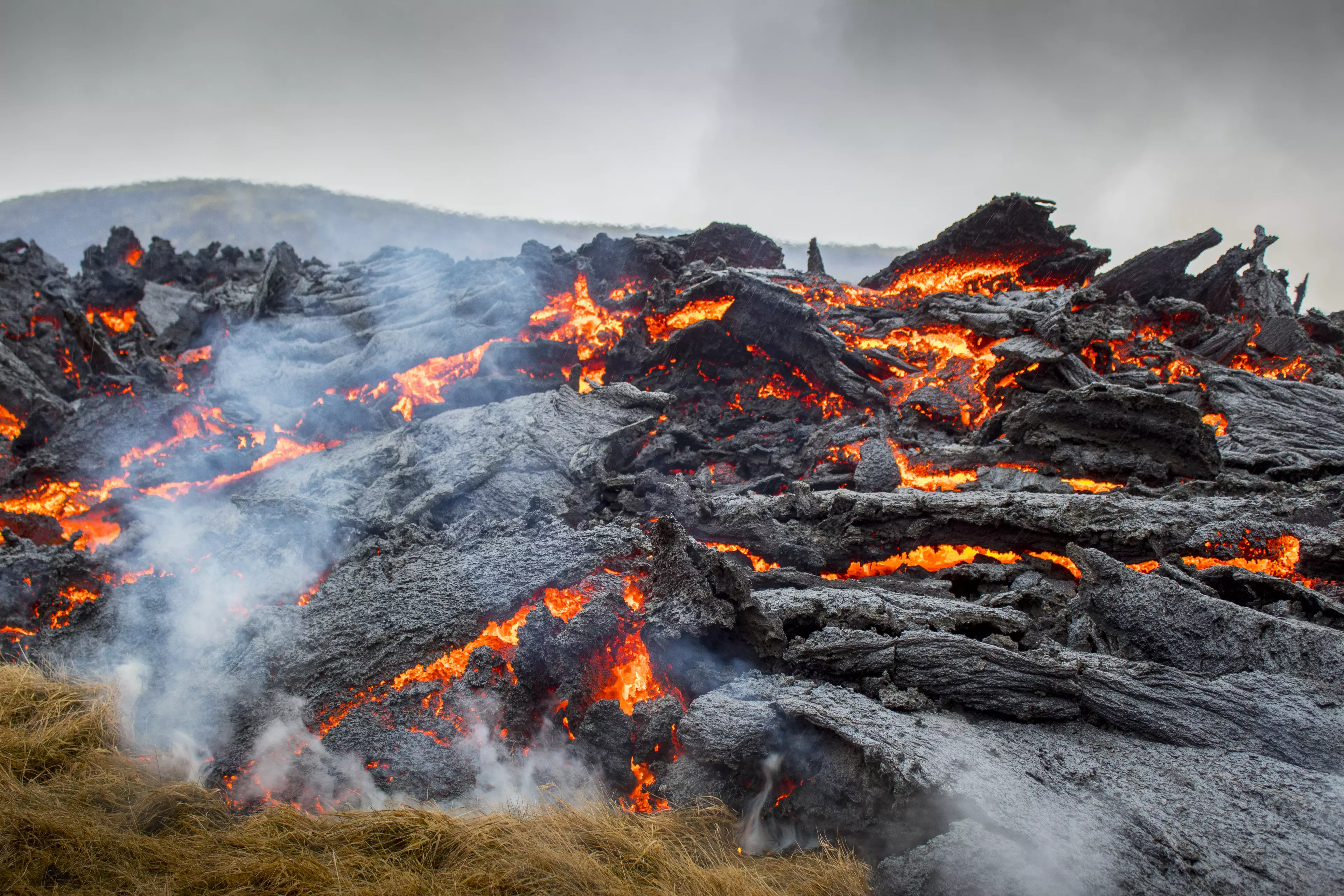
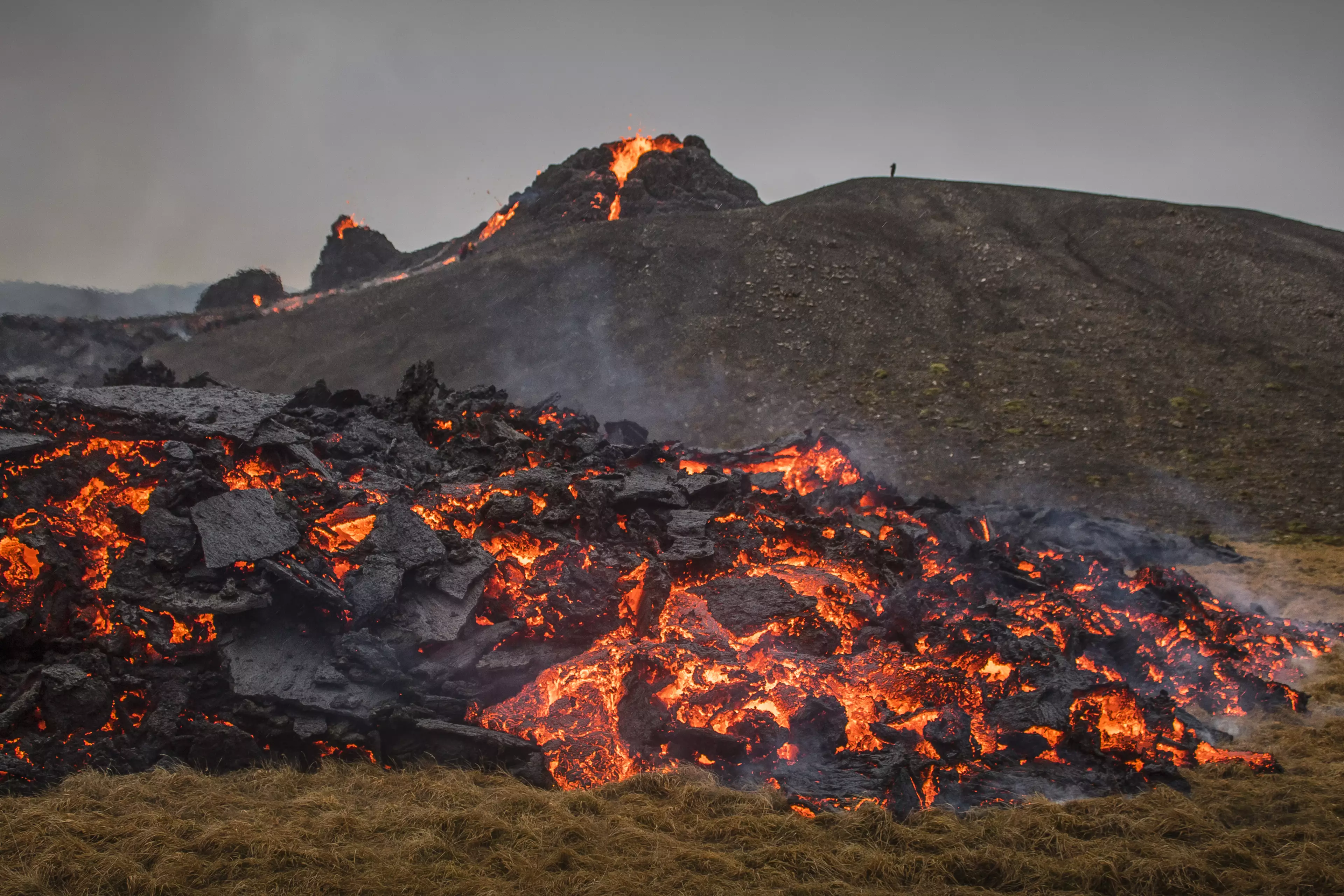
In the footage, the drone sweeps over the volcano, which is 1,263 feet tall. The images shows lava flows and fountains of molten rock.
Seinbekk is a marketing strategist and content creator, who focuses on drones. He lives in Reykjavik, the capital of Iceland.
Speaking about the eruption, the Icelandic Meteorological Office said it was relatively small, but it did follow a rise in seismic activity in the area.
Advert
A tweet, roughly translated, reads: "The eruption is small and activity has decreased somewhat since yesterday. There are few magma jets and the lava flow covers an area that is at most about 500 meters wide. The eruption is limited to a small area in the valley and it is unlikely that lava flow will cause damage."
The BBC reported that the IMO said: "Currently gas pollution is not expected to cause much discomfort for people except close up to the source of the eruption. The gas emissions will be monitored closely."
The Department for Civil Protection said there was low threat to the public in the area.
Advert
The volcano erupted for the first time in 800 years following an increase in earthquakes.
The fissure is about 500-700 metres long at Fagradalsfjall on Reykjanes peninsula, approximately 30km south-west of the country's capital Reykjavik.

The Iceland Meteorological Office (IMO) said the eruption of Fagradalsfjall began at around 8.45pm GMT on Friday (19 March), later being confirmed via satellite imagery and webcams.
Advert
Several hours beforehand, a magnitude 3.1 earthquake was recorded 1.2km from Fagradalsfjall.
According to Reuters, four hours after the initial eruption - the first on the peninsula since the 12th Century - lava covered around one square kilometre, the equivalent of nearly 200 football fields.
Rannveig Gudmundsdottir, a resident in the town of Grindavik, only 8km from the eruption, told the news agency: "I can see the glowing red sky from my window.
Advert
"Everyone here is getting into their cars to drive up there."
Featured Image Credit: Bjorn Seinbekk via StoryfulTopics: World News, Volcano
