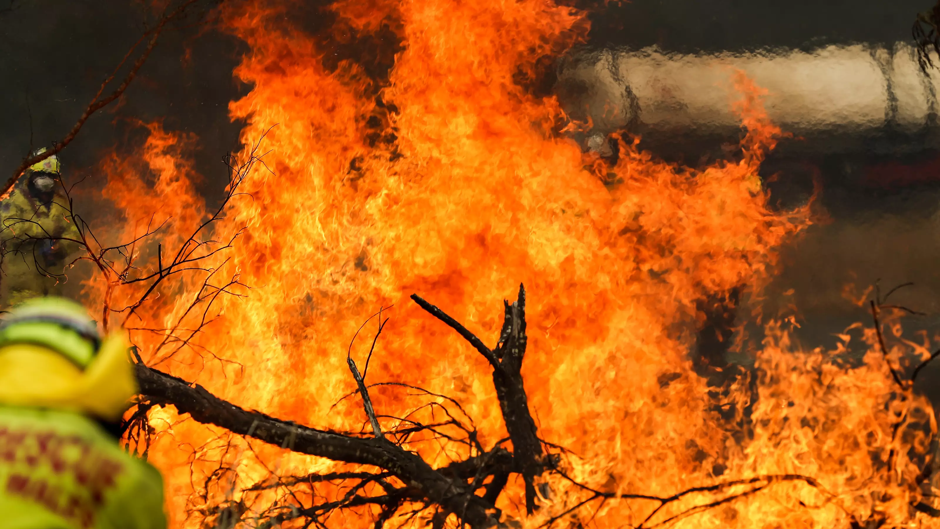

Most Australians will be able to tell you just how devastating the most recent bushfire season was to the community.
Whether you were in a city that was choked by a smoke haze that lingered for weeks, or you were in the thick of it and lost your home or livelihood, the fires affected us in so many ways.
While we all know that it wiped out millions of hectares of land, it's hard to put that into perspective. Thanks to the Australian government's Geospatial Intelligence (GEOINT), you don't have to try and imagine the scale of the devastation.


New satellite photos have been released to show the magnitude of what happened over those spring and summer months.
Advert
In New South Wales alone, there was a whopping 5.5 million hectares of land wiped out.
Chief Executive of Geospatial Intelligence Rob Coorey said in a statement: "[Satellite imagery] has a very, very high value in the pre-fire planning periods, so this period now coming up into the fire season.
"It's not one panacea which is going to be the solution to everything, but it has a really great role to play and is, in actual fact, very cost-effective when you're looking at the sorts of things the [Government] uses it for."
The data collected from GEOINT weighed up to an impressive 100 terabytes, which will be used by authorities and experts to determine just how quickly and how wide the fire was able to spread. It's hoped information like this will be able to help authorities tackle mega-blazes like these in the future.
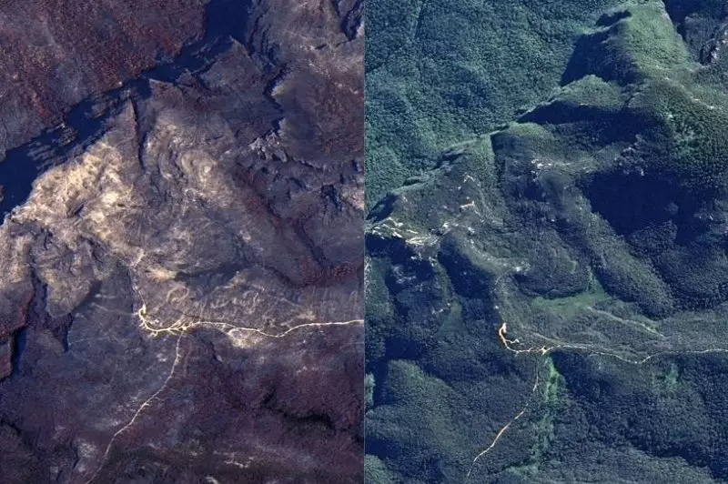
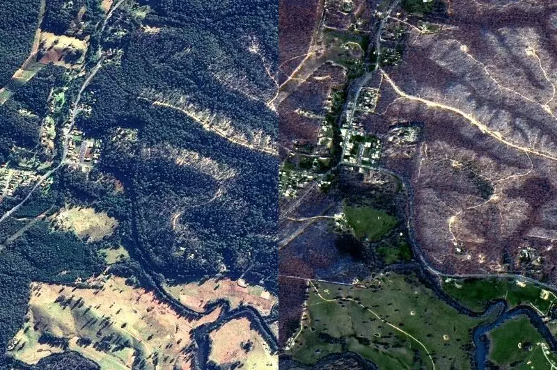
Some of the big standouts from the satellite imagery is of the Blue Mountains and Mogo, which were absolutely decimated during the bushfire season last year.
Advert
Mr Coorey added: "The fire around the Blue Mountains was extremely intense...to the point where you could actually see how the fire tornadoes have left scarring across the land.
"You can almost see the pattern for when the wind changes with these tornadoes. It'll be going from north-west to south-east and then maybe an easterly direction."
While the widespread devastation is tough to witness, the imagery also shows how some parts of the country are regenerating in the months since the infernos. This data will also be used by authorities to see where the potential risks are for the upcoming season.
The Department of Customer Service NSW is already warning that the 2020-21 bushfire could be worse than the one just past. Fingers crossed they are wrong.
Featured Image Credit: PATopics: News, bushfire, Australia