
Everyone knows Australia comes alive during the summer: the drinks taste better, the sun is shining and everyone is just generally happier.
But when the good times fade and winter rolls round, there's not much to get excited about - unless you're heading to the snow.
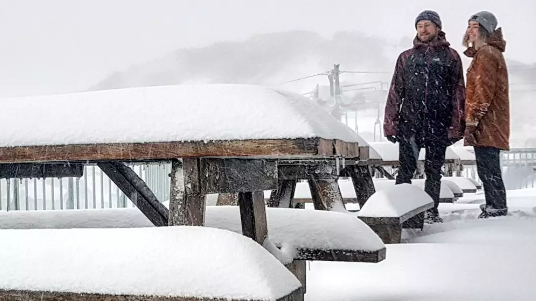
Well, you can get extra excited about that trip after some hot spots across Victoria, Tassie and New South Wales copped an absolute battering of snow over the weekend.
The official ski season doesn't kick off until June 8 but it looks like winter has come early at places like Mount Hotham and Falls Creek with around 25 centimetres falling over the weekend.
Further north, about 20 centimetres of snow fell at Perisher and around five hit Thredbo.
Perisher wrote on their website: "We have seen significant snowfall overnight and it looks like there is no sign of it slowing down!! WOOHOO! The resort is looking awesome.
"With less than two weeks until Opening Weekend Mother Nature has delivered the goods! Additionally the temperatures have dropped into the negatives and the snowmakers are out doing what they do best, blasting the snowguns at every opportunity."
Advert
According to Mount Hotham's Twitter page, there are snowfalls expected around the area for the next four days, meaning the mountain will have the perfect foundations for a bumper ski season.
The Bureau of Meteorology said the Snowy Mountains can expect 'a series of cold fronts crossing the state will bring windy conditions until the midweek'.
"A cold, unstable westerly airstream prevails across Victoria in the wake of a cold front that now lies over the Tasman Sea," the forecast continued. "Another strong cold front will move up from the Southern Ocean on Tuesday night and cross the State on Wednesday as a large high pressure system develops south of the Bight.
"The high is expected to remain south of the Bight on Thursday. Winds should ease during the later part of the week as a strong high pressure system over the Bight, with its associated ridge extending toward the eastern New South Wales, becomes the dominant weather feature."
Fingers crossed the conditions stay like this and we'll be in for a brilliant season.
Featured Image Credit: Mount Hotham/TwitterTopics: Weather, News, Australia

