
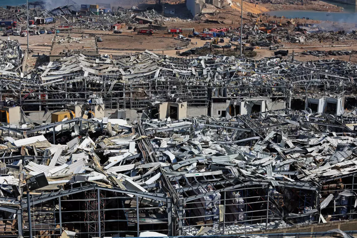
Following the disastrous explosion in Beirut yesterday, shocking images have started to show the sheer scale of the damage - following reports that it could be felt up to 200 km away in Cyprus.
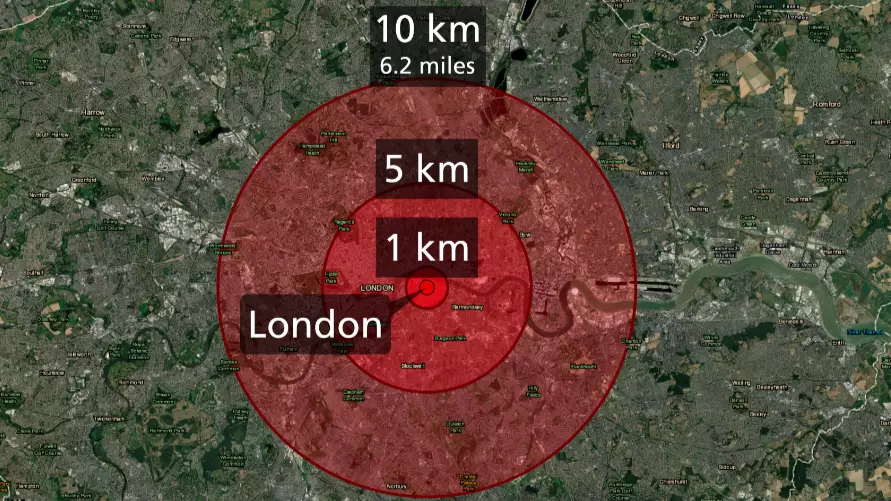
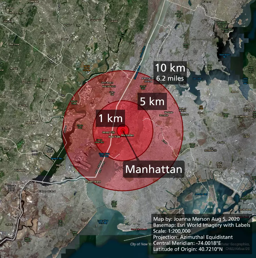
Professional cartographer Joanna Merson has even created a series of images to show what the extent of the blast in comparison to cities like London or Manhattan.
Merson created the graphics after spotting a similar viral picture, which was incorrect.
Advert
Sharing her images, Merson tweeted: "This morning I woke up to see viral maps incorrectly comparing the damage area of the Beirut explosion to London and New York. I have corrected the maps with a little thread to explain my corrections [...]

"A curious and well intentioned person used an online tool that slaps circles onto google maps, but none of the maps show any distances or scale. And the google maps are, of course, projected in Web Mercator, which does NOT show distance equally across different latitudes.
Advert
"I picked the 10km radius by measuring the distance to the airport runways in the original map. The circles ignore all topography, while it looks like the actual damage stretched farther along the coastline and not as far inland, uphill(?)."
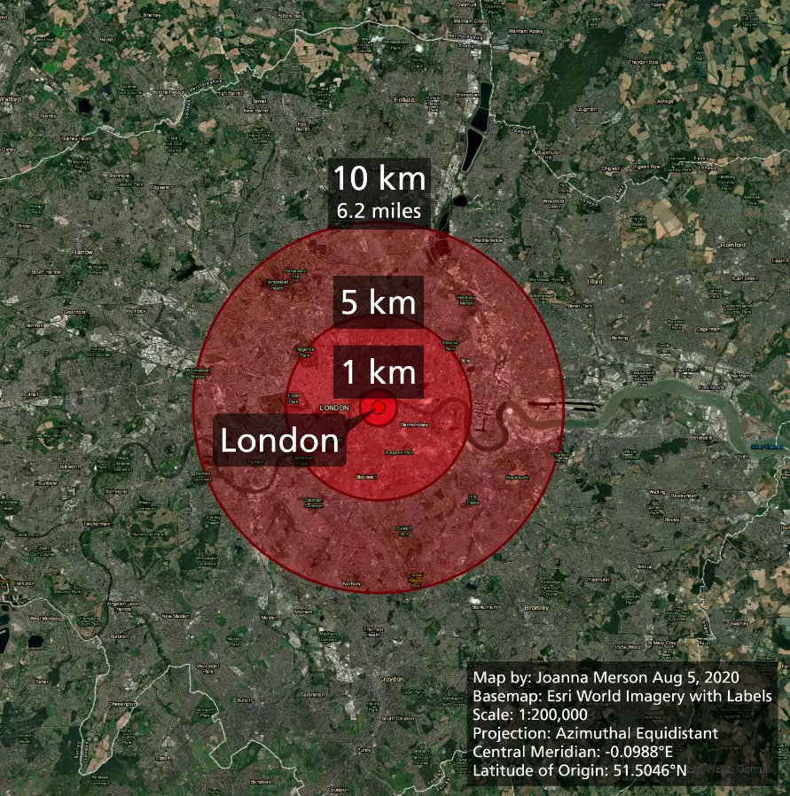
She added: "My maps use azimuthal equidistant projections, centered on each POI, and are displayed in the same scale, so they can be compared. BECAUSE SCALE AND PROJECTIONS MATTER. Enjoy."
Explaining how the images worked, Merson also told LADbible: "These maps don't model what would happen if the explosion would have happened in the other cities. They just let you compare the size of Beirut's initially reported damage area to other cities, so people can get a better sense of the size of distance - if they are familiar with those cities."
Read Merson's full thread on Twitter here.
Advert
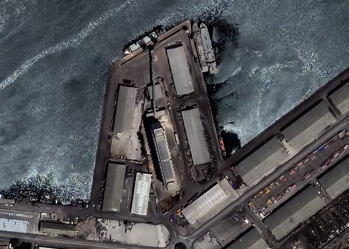
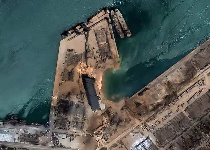
European Space Imaging has also released a series of before-and-after photos to show the levels of destruction in the area.
Adrian Zevenbergen, Managing Director, European Space Imaging, said: "When disaster strikes, VHR satellite imagery can provide critical information for emergency relief operations to evaluate the extent of damage and get an entire overview of the scene.
"It supplies crisis management teams with logistical insights for planning and helps to monitor and detect any changes that may be critical to minimising or even eliminating further catastrophe."
The explosion shook the Lebanese capital yesterday at around 6pm local time, killing more than 125 people and injuring more than 4,000 - also triggering a two-week state of emergency.
Advert
Lebanon's prime minister Hassan Diab has said the explosion was caused by 2,700 tonnes of ammonium nitrate, which is used to make fertilisers and explosives, that had been stored in a nearby port warehouse for the past six years.
These claims have also been backed up by the country's General Security chief Abbas Ibrahim, who blamed the blast on 'highly explosive material' that had been confiscated years earlier and kept in the warehouse.
In an emergency cabinet meeting on Wednesday, President Michel Aoun said: "No words can describe the horror that has hit Beirut last night, turning it into a disaster-stricken city."
Advert
Terrifying footage of explosion was posted on Twitter yesterday evening in the wake of the incident.
In the clip, which appears to have been taken from a rooftop nearby, a large cloud of smoke suddenly erupts into the air as a deafening noise ripples through the city.
It was posted with the caption: "A video I received on WhatsApp of the scale of explosion in #Beirut, confirming it was at the port.
"FYI - this comes at one of the worst times in Lebanon's history, a deep economic crisis with more and more of the population unable to access food, health care. The general mood was that it can't get worse.
"Many people barely surviving and now more have lost their livelihoods, shops and cars destroyed."
Featured Image Credit: Joanna Merson/PATopics: World News, News