

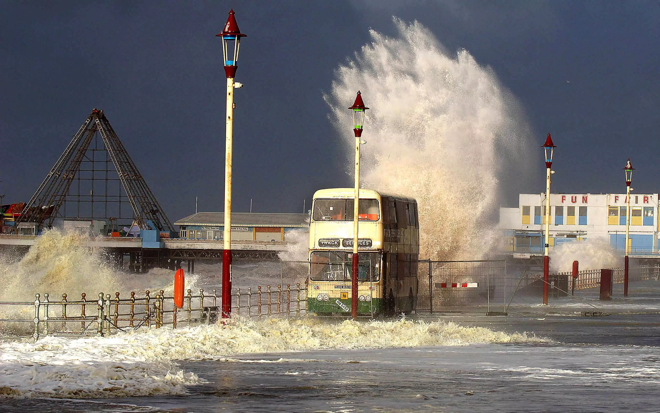
If you enjoy heading over to Blackpool for fish and chips or strolling along the beachfront at Norfolk you might not want them to be underwater come 2050.
New predictions have found that rising sea levels could cause damage to coastal regions around the UK meaning that different areas are being threatened by the climate crisis.
Rising temperatures are resulting in a reduction in sea ice, rising sea levels and longer, more intense heatwaves and this could have detrimental consequences.
Advert
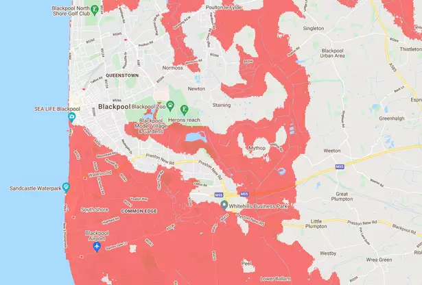
Research carried out by Climate Central, a non-profit news organisation focused on climate science, has revealed areas of Blackpool, Lytham, Fleetwood and Morecambe could be underwater by as soon as 2050.
Lancs Live reported that Lancaster, Thornton-Cleveleys, Heysham, Preston, South Ribble, West Lancashire and Southport may also be affected.
According to the research, changes will come gradually over a number of years but once they become noticeable it will be too late to stop them.
Advert
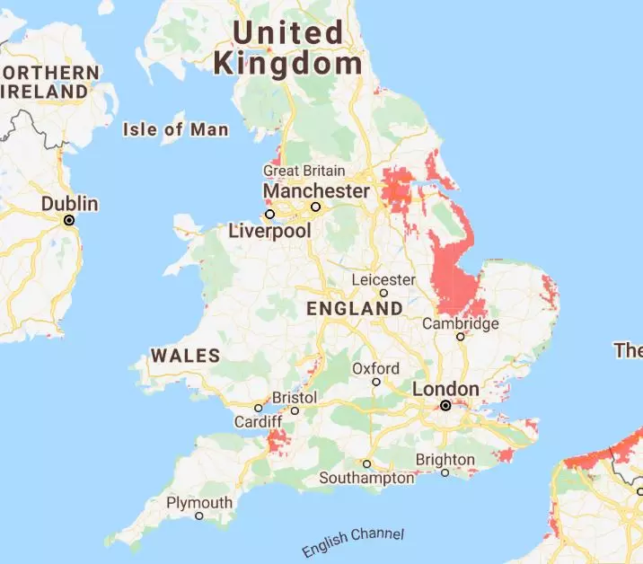
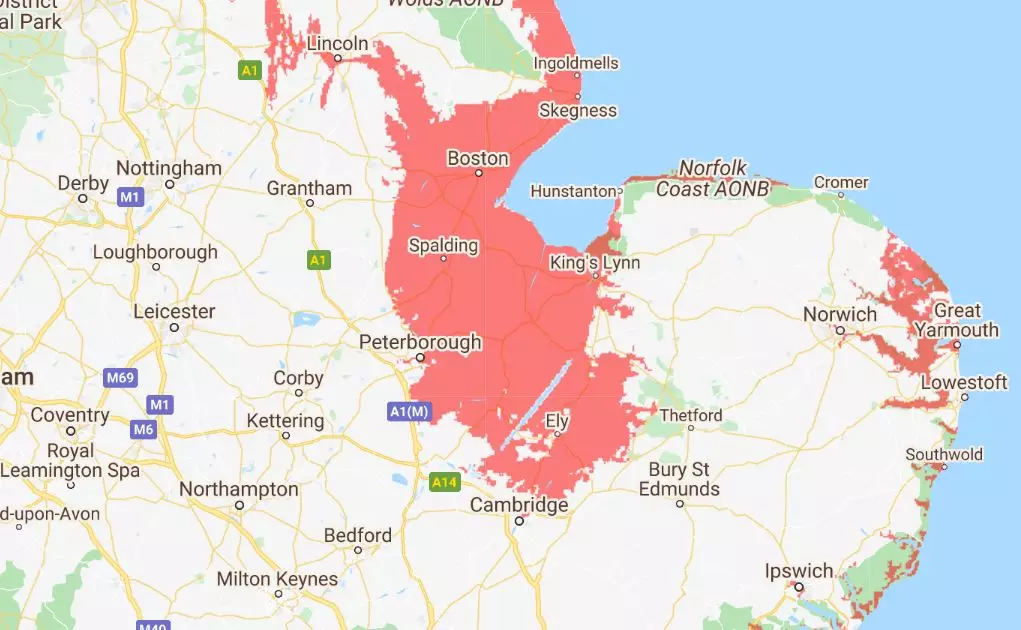
Maps show the rising sea levels and how they will impact local areas, especially if we make no cuts to emissions.

On top of this Fleetwood and Cleveleys could be in a similar position as well as Morecambe, Heysham and Lancaster.
Advert
Parts of Hull also look likely to be underwater over the next few decades as well as Scunthorpe, Grimsby and Howden.
Norfolk and areas of Lincolnshire will possibly be impacted with the map showing a huge red patch over Boston, Wisbech and Ely, in Cambridgeshire.
The map goes on to show that areas of the capital will disappear with patches around Greenwich, Barking and Ilford.
Advert
It also looks as if parts of the south coast will succumb to water with Portsmouth, Bognor Regis and Worthing all covered red.
This comes after scientists from the World Meteorological Organisation (WMO) said the world could reach the 1.5C danger threshold in the next five years.
They estimate that there is a 40 percent chance that one of the coming years will record 1.5C hotter than the pre-Industrial average set out to avoid in the Paris Climate Agreement.
Featured Image Credit: Creative Commons