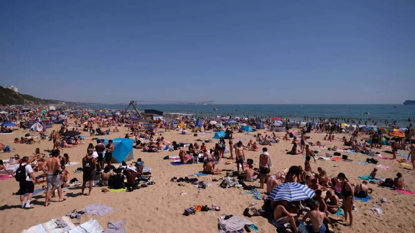

A heatwave this weekend could bring the hottest day of the year so far, with the Met Office predicting highs of up to 28°C or 29°C in some areas.
So far, the warmest day we've had occurred on 2 June, when temperatures reached 28.3°C in Northolt, West London.
However, according to the Met Office, this weekend could see even warmer weather heading our way thanks to 'above average' temperatures for early June.
Advert
While some parts of the UK saw showers and cloudy conditions on Thursday, things will likely start settling on Friday (10 Jun) before welcoming hotter temperatures for the weekend.
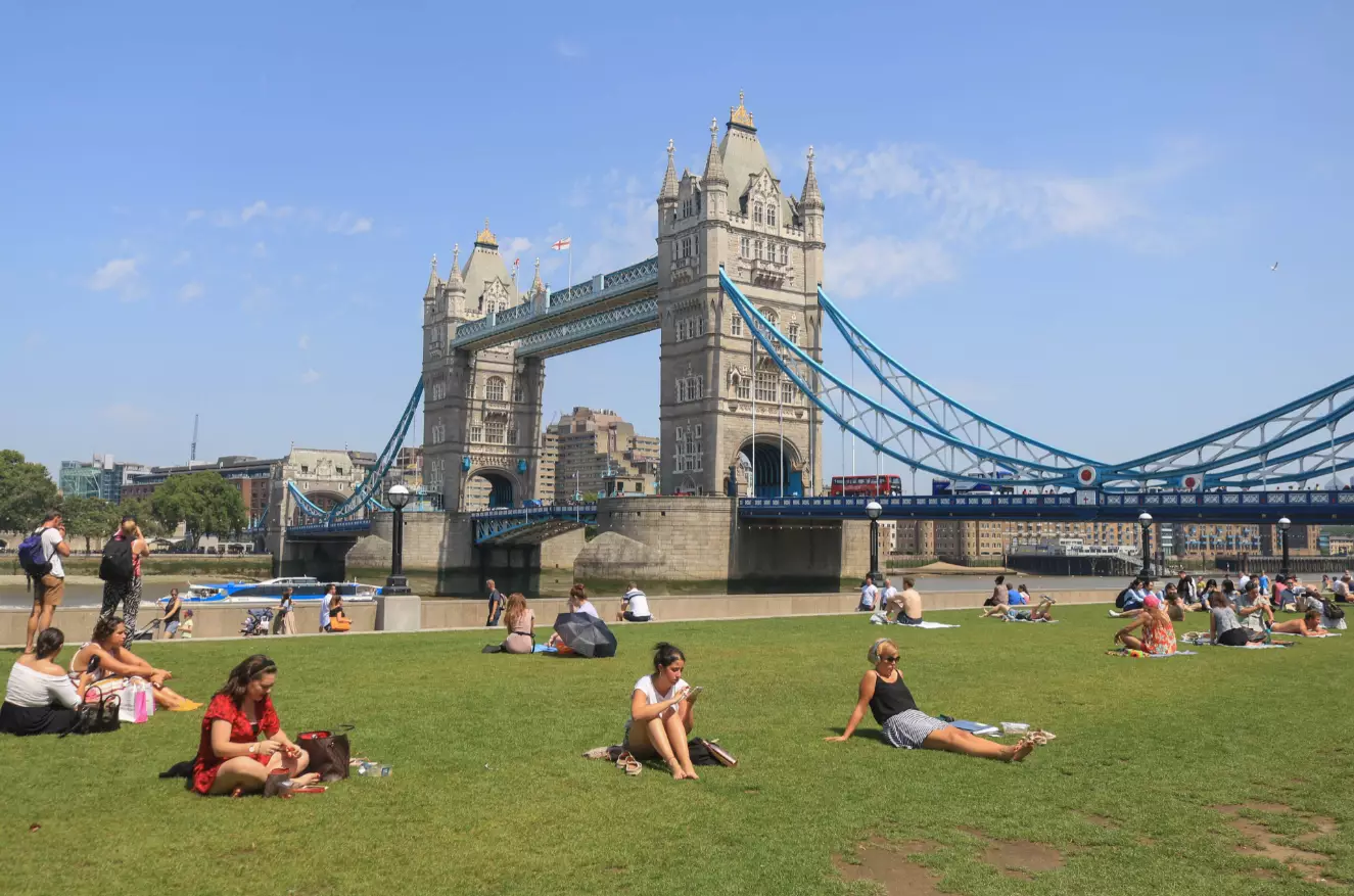
The Met Office confirmed to LADbible that on Saturday, many areas will enjoy highs of around 25°C, but on Sunday things could be as high as 'potentially 29°C' in regions such as the South East.
A spokesperson said in a statement: "High pressure will build across much of the UK this weekend, bringing plenty of sunshine especially across England and Wales.
Advert
"Temperatures will be above average for early June, rising to around 25°C on Saturday and 28°C on Sunday.
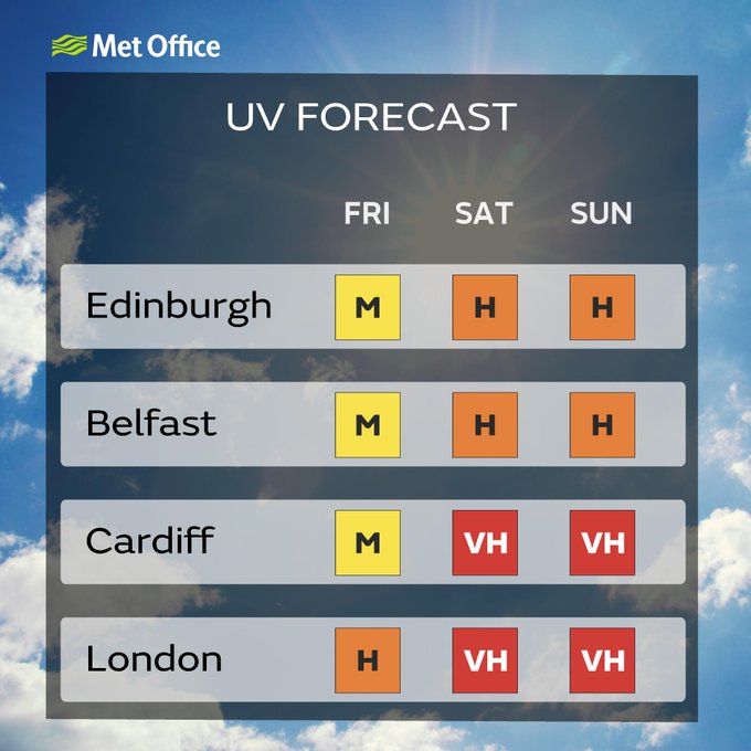
"It is worth remembering that UV and pollen levels will be high or very high throughout the weekend."
And the good news is that this sunny weather is also set to continue into next week, with some areas including the South East predicted temperatures of up to 29°C on Monday 14 June.
Advert
As for longer term, a general UK forecast from the Met Office for the period between 14 and 23 June says temperatures are expected to be 'very warm', but that there will also be spells of bad weather at times.
It says: "High pressure across the majority of the UK looks to bring a lot of dry and settled weather at first. However, in the far north outside of the influence of this, there will be spells of cloudy, windy and wet weather at times.
"There will be a risk of showers in the south, especially mid-next week, which could even culminate in a thundery breakdown.
"Temperatures are expected to be very warm under the high, perhaps hot for a time in the south east, but look to remain average in the far north.
Advert
"Into the latter half of this period, there are signs that less settled conditions could push in from the north west to other parts of the country."
It adds that temperatures are set to return to 'nearer normal by the end of the week'.
Featured Image Credit: PATopics: Weather, UK News, News, heatwave