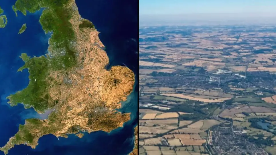
Map shows UK covered in yellow as Met Office warns of 'scary' heatwave
Satellite images of the UK make for scary viewing as they show how parts of Britain have turned a desert-like yellow due to the heatwave and recent dry weather.
The Met Office issued a four-day extreme heat warning for much of England and Wales that came into effect today (11 August).
An amber weather warning is in place until Sunday 14 August and people have been told to expect temperatures in the mid-30s.
While we're not expected to see temperatures climb quite as high as they did a few weeks ago when the highest ever temperatures in the UK were recorded, it's still going to be a dangerous time for many.
Advert
Met Office warnings about the heatwave make for grim reading, and taking a proper look at the impact high temperatures have had on the UK is startling.
James Cheshire, professor of Geographic Information and Cartography at University College London, shared an image of what the UK looks like via satellite images, and it's quite disturbing.
While we normally associate the image of the UK with that of a green and pleasant land, these images show the toll the heatwaves have taken on the land.
Professor Cheshire's images show dry ground spreading across the UK and snaking up the east coast, all the way up to Scotland, the usual green hue overtaken by the arid heatwave.
He said: "I've been obsessively checking satellite imagery to witness the UK turn from green to yellow, thanks to the period of extreme heat and lack of rain Europe has been enduring.
"The parched landscape is unlike anything I've seen before and a cloud free day today (10th August) has revealed the true extent of the drought."
"It shows with extraordinary clarity where the UK gets the most rain (and where some has fallen) thanks to being more to the west or at higher elevations."
Some people have responded to Professor Cheshire's satellite images claiming that there's really nothing to worry about as many crops are going yellow as they approach harvest time.
Addressing those claims, he explained that while plenty of crops are indeed going yellow, we've just had the driest July since 1935 with such little rainfall that much of the British countryside is feeling the heat.
He also compared what the UK looks like at the moment with the way it looked during the last summer of incredibly hot weather in 2020, and the difference between then and now is pronounced.
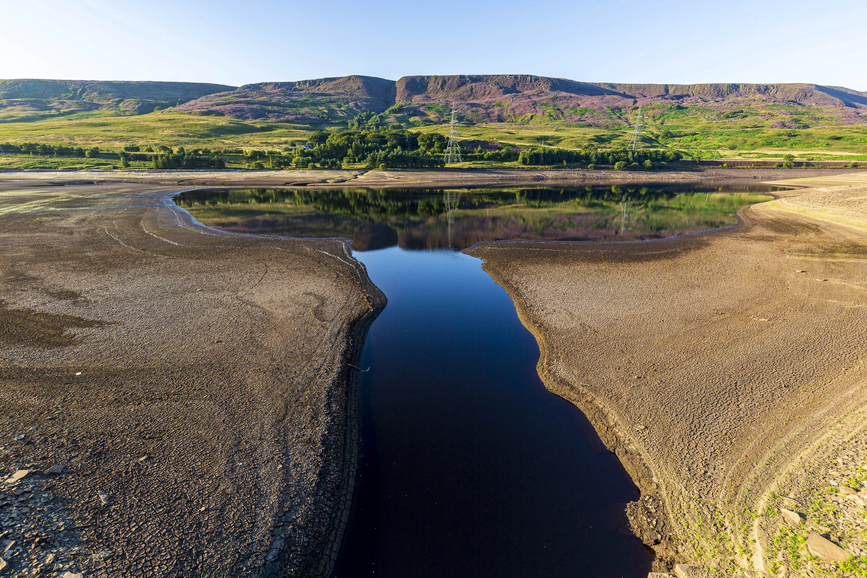
Another symptom of the heatwaves hitting the UK is dangerously low water levels, and there are fears that parts of the country will be struck by droughts.
Topics: UK News, Weather, Global Warming