Lost medieval town discovered in Norway after a decade-long search
It's strange to think an entire town could go missing, but that's exactly what happened to one medieval town which completely fell off the map in Norway.
For almost 10 years, researchers from the Norwegian Institute for Cultural Heritage Research (NIKU) have been trying to locate the urban settlement of Hamarkaupangen in Hamar, on the south east coast of Norway.
Although artefacts from the missing town have been found in the topsoil over the years, the actual location of the town remained unknown - until recently.
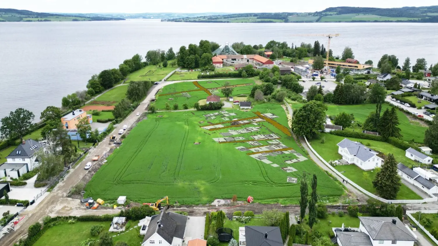
After extensive research, NIKU's Digital Archaeology department managed to track down the 16th century town's exact location using ground penetrating radar (GPR) surveys on the fields of Domkirkeodden, where the Hamar Cathedral ruins lie.
Advert
The results of the GPR surveys, which use electromagnetic pulses to analyse the ground based on the reflected signals, revealed urban features like street alignments and buildings on the Kringkastingsjordet field.
Archaeologists Monica Kristiansen, Jani Causevic, and Ole Fredrik Unhammer used a 16 channel motorised GPR system from Guideline Geo; the same equipment that was used to identify the Viking ship at Gjellestad in 2018, in just one day.
Despite the initial survey taking place so quick, the team took several weeks to interpret the data they had gathered and its fair to say it was well worth their efforts.
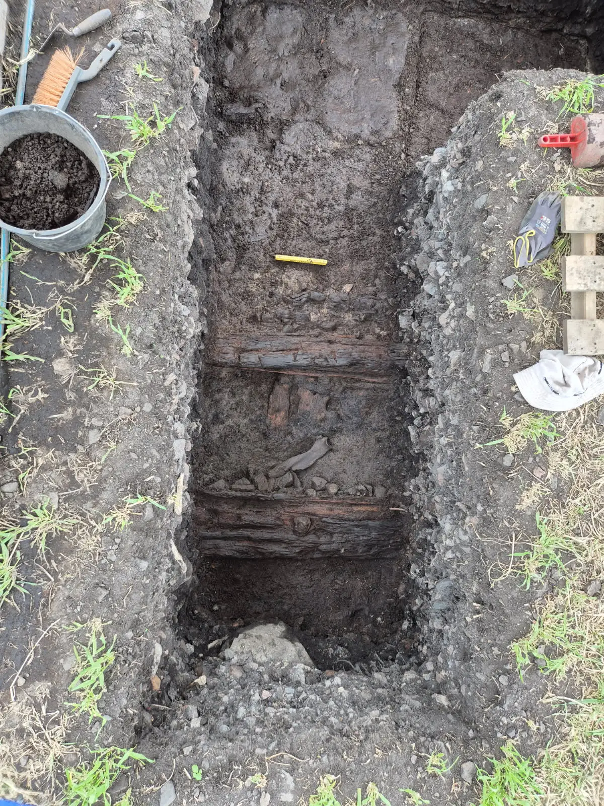
A recent excavation of the area confirmed the team had successfully located what is left of the missing town as archaeologists have begun uncovering timber remains from underneath a metre of cooking stones.
A sample of the timber has been sent for radiocarbon dating to determine its age, and it's hoped the results will be back within the next week.
"We were eager to see what lay below ground," Kristiansen said. "The thick layers of cooking stones presented a new context for us – we had no prior experience of how these stone-filled layers might affect the visibility of wooden structures in the GPR data."
"Moreover, preservation conditions for organic materials in this area are generally poor, so we expected the remains of the timber buildings to be in poor condition.
"It is therefore extremely encouraging that the radar interpretations are being confirmed."
The excavated area so far only covers four square metres, but these findings already go a long way towards understanding what life was like in the town back in the 16th century.
It's hoped further investigations will only add to the depth of understanding.
Topics: Archaeology, History
 Emma Rosemurgey