Newly released photo from airline pilot showing '1000ft UFO' has been debunked on Google Maps
A newly released photo from an airline pilot supposedly showing a '1000ft UFO' has very quickly been debunked on Google Maps.
As the years go by, and the technology gets better, you'd think that we would be able to easily spot UFOs or UAPs, as they are called.
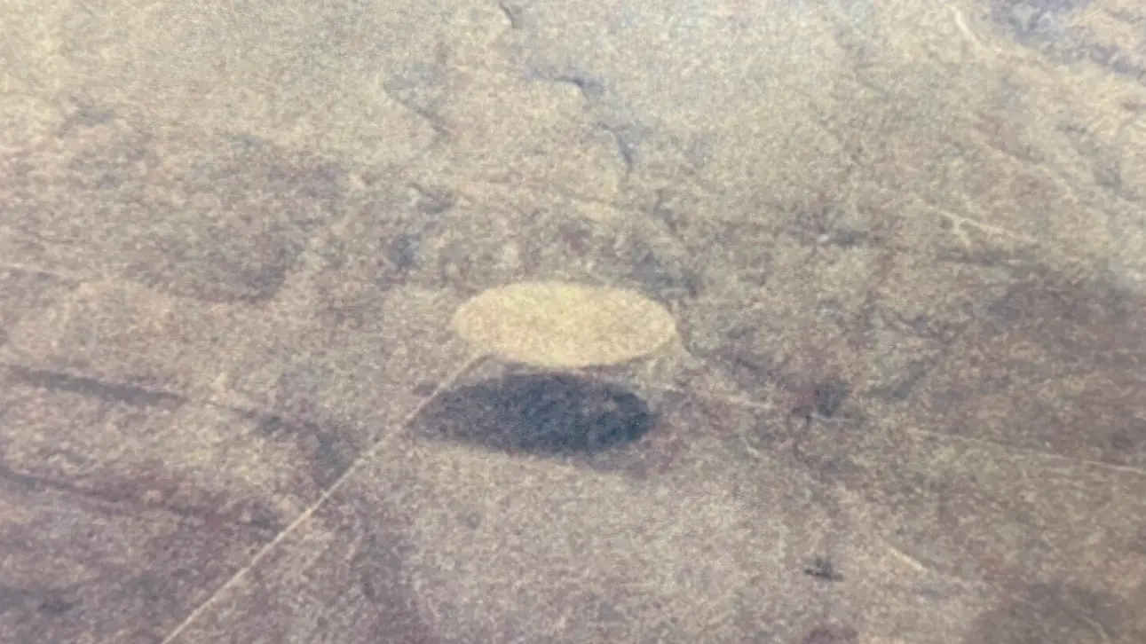
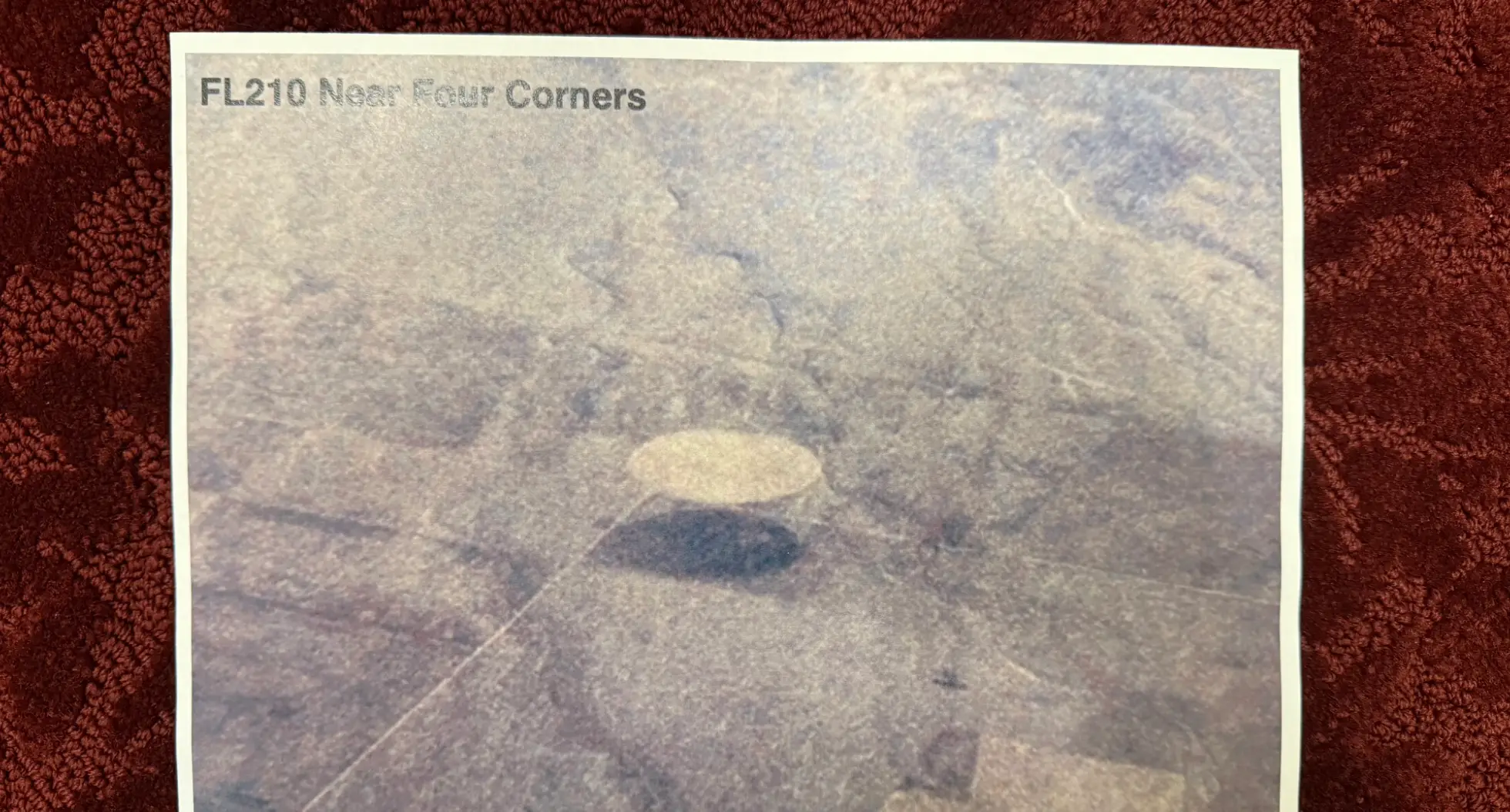
It comes after the UAP Disclosure Fund account (@UAPDF), which promises 'to promote greater understanding' of UFOs, recently shared an image on X of a 'disc-shaped' object taken by a 'civilian pilot.'
"Captured near Four Corners at FL210—estimated 600-1,000 ft in diameter, silver-hued, disc-shaped," the account explained alongside the pic.
Advert
It appears the photo had been 'released' by Lue Elizondo, a former director of the Advanced Aerospace Threat Identification Program (AATIP).
The AATIP was once a US government program that investigated UFOs from 2007 to 2012.
"Released moments ago by @LueElizondo during our 'Science, National Security & Innovation' panel," the X account added.
"Several speakers confirmed DoD & IC hold hundreds of similar UAP images + sensor files still classified.
"It’s time for full declassification and open scientific analysis."
Despite seeming pretty convincing at first glance, people were very quickly able to debunk the image by using Google Maps.

Users were simply opening up the map service and pasting the northern coordinates, which are 36.4014 ° N, –108.1791 ° W (36° 24′ 05.0″ N, 108° 10′ 45.0″ W).
One debunker (@JoeCal422) then explained how he tilted 'the view from ~21 000 ft (≈ FL210) and you’ll see the same light/dark circle pair with a diagonal service road.'
"Measure the circle diameter: ~0.5 mile (800–1 000 m), standard for NAPI pivots," he wrote.
"Historical imagery (2020-2021) shows the same fallow/vegetated contrast that produced the 'saucer + shadow' illusion."
Another person added: "This is clearly a crop circle, not a UAP. Mislabeling known terrestrial phenomena erodes public trust and undermines legitimate disclosure efforts."
As someone else said: "The disc-shaped 'object' is not flying; it’s a pair of centre-pivot irrigation fields on Navajo Agricultural Products Industry (NAPI) land, southeast of Four Corners Monument."
"Are you guys serious? Have you never flown in a plane before?" a fourth wrote.
"These agricultural circles are extremely common.
"The second one just looks like they did a recent field burn of it."
"It's 2025, cameras are everywhere and better than ever, yet UFO grifters still have to rely on photos from the 60s and 70s....probably because modern cameras keep capturing in detail the reflection of the hoaxer taking the picture, lol," a fifth penned.
Topics: Aliens, Space, Twitter, UFO, Google Maps