Exactly why October has felt so warm in UK as Met Office experts issue verdict

We may now be in the Pumpkin Spiced latte season, but the weather has certainly been saying otherwise.
Despite autumn being firmly upon us, the continuous warm temperatures throughout the UK are still baffling people online.
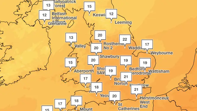
Flurries of posts on the likes of X and TikTok have been shared questioning how in some areas temperatures have reached high teens or even low 20s in recent days.
Temperatures throughout September remained around 20C, which followed in this year's trend of the above-average forecasts in the UK.
Posts from Brits have included one which read: "Is no one concerned that its still 20c in October? Like why am i still able to leave the house without a jacket of any kind? Why has it been like this since March?"
Advert
Another meanwhile posted to X: "Alarming how warm it is in the UK in October. I mean it helps when we don't have to turn heating on with the current gas prices though."
Last month became the joint-fourth warmest September on record, which followed a blazing hot summer, with the UK basking in the second warmest June and second warmest July ever.
October has also so far shown no sign of letting up, with the dry and mild conditions certainly not going unnoticed.
The Met Office has told LADbible exactly why the start of October has felt warmer than normal, mainly due to air mass, but that it's not actually quite as dramatic as we think and the dry conditions aren't going to last.

Warmer air mass is causing impact
Stephen Dixon, Met Office spokesperson explained: "October has started warmer than average for the time of year, but not in a historically significant way.
"We’ve reached into the low 20s Celsius today while the average daily maximum temperature for this month is 13.1C.
"That being said, the natural variability of the UK climate means that we can indeed see temperatures into the 20s, even in October.
"The temperatures at the moment are largely down to a milder air mass over southern parts of the UK, helping to keep temperatures above average for the time of year."
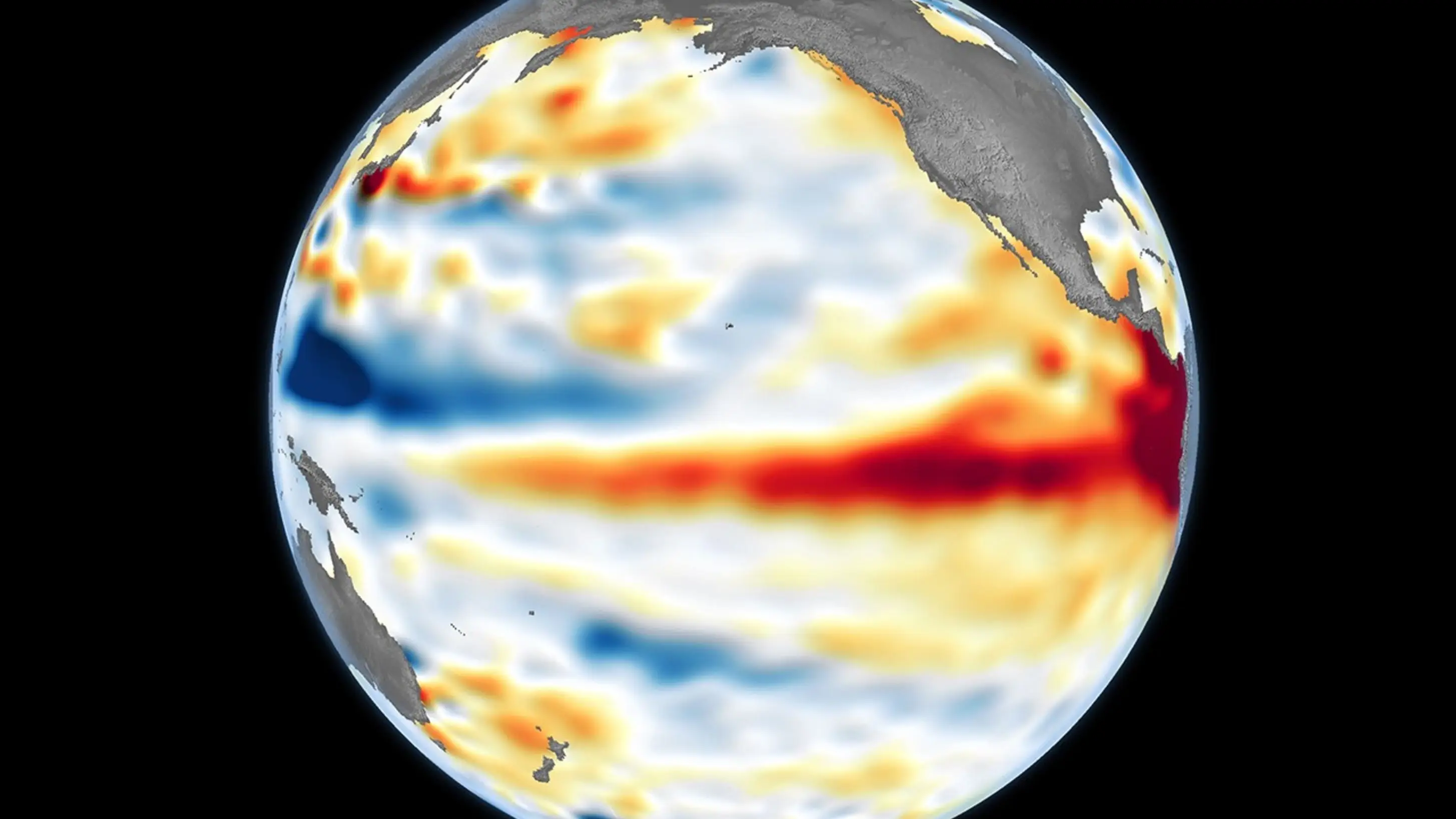
It comes amid concern over the El Niño weather event which is a warmer phase of global weather patterns that can drive more extreme weather alongside climate change.
This is set to cause drought in some areas, and could put the UK at a greater risk of a wet, stormy autumn.
Drought pressures will persist in some areas even if wetter conditions arrive, officials said, with climate change meaning the country is seeing an increase in both drought and flooding, which can happen simultaneously.
Asked about its impact on current weather, Stephen Dixon explained: "El Niño is one of a number of large-scale atmospheric drivers that influence weather patterns in UK and Europe.
"However, other atmospheric and oceanic factors will continue to play an important role in determining conditions over the coming months.
"It could lead to more wet and stormier conditions later in autumn and early winter, while it could also bring drier, cooler and more settled conditions later in the winter.
"However, no single weather event in the UK can be attributed to El Niño alone and much will depend on its interaction with other climate drivers."
Conditions set to change
Despite the recent warmer conditions, there is set to be a change throughout this week.
The comfortable above-average temperatures will give way to cooler conditions spreading from the north, the Met Office has confirmed.
Wet and blustery weather will move across some northern parts of the UK and introduce chillier air later in the week.
In its outlook for the week, the forecaster explained: "Generally cloudy with spells of drizzly showers, although there may be some brighter spells in the afternoon, particularly in the south.
"A brisk breeze, particularly on coasts and hills, easing through the day. Feeling mild. Wednesday and Thursday will be bright with sunny spells and a cool, autumnal breeze.
"Showers most likely over mountains on Wednesday. A return to mild, unsettled weather on Friday."
However looking ahead, the conditions are expected to change. From the middle of October, a series of 'low pressure systems' will run across the North Atlantic bringing bands of rain and strong winds.
"Whilst brief cooler interludes are possible, temperatures are likely to be a little above average in many areas for the period as a whole," the Met Office added.
 James Holt