El Niño's terrifying warning after recording joint hottest month ever - and conditions will get worse

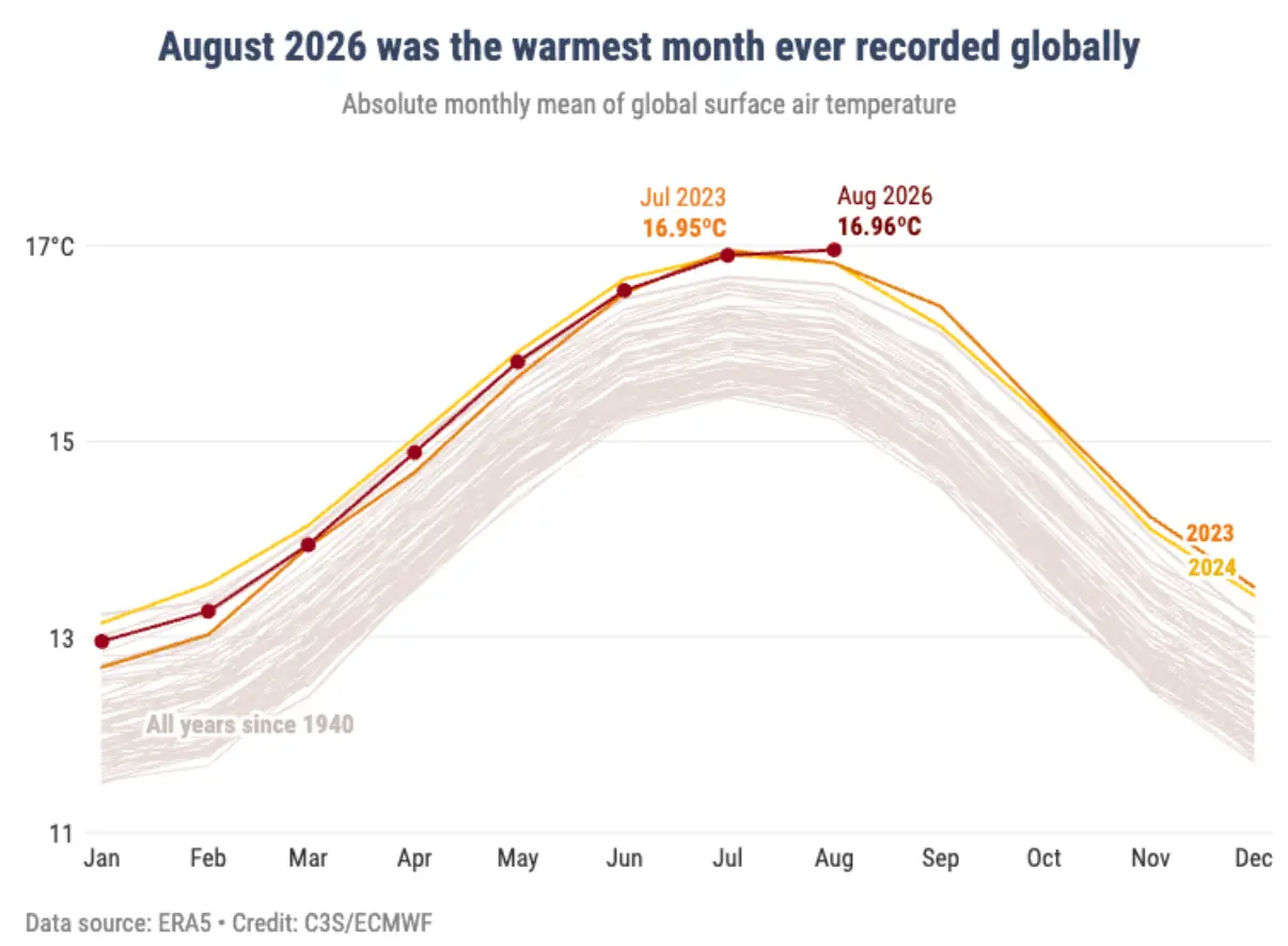
Weather warnings are sounding over the conditions building up to an El Niño as we just had the joint hottest month since records began.
August 2026 is tied with July 2023 for high temperatures, and a rapid increase in sea surface temperatures along with it means the conditions are there for a very strong El Niño.
Scientists have anticipated this and been warning that we're in for the 'biggest El Niño ever', with the main impacts to be felt in the Pacific Ocean though the consequences will ripple around the world.
The United Nations has been telling countries, including the UK, to stockpile food for a particularly harsh winter as the El Niño is expected to make weather events more extreme.
Advert
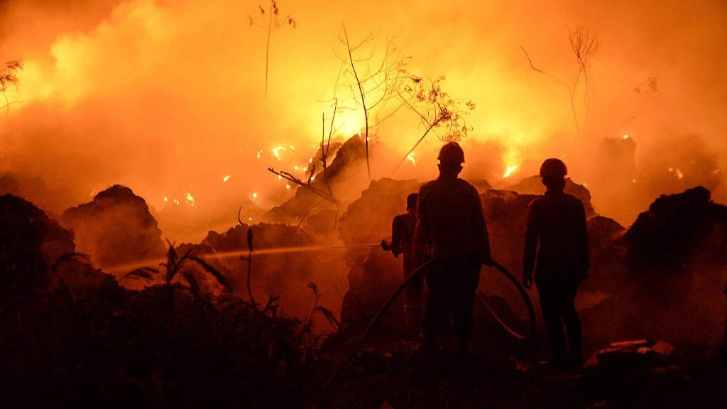
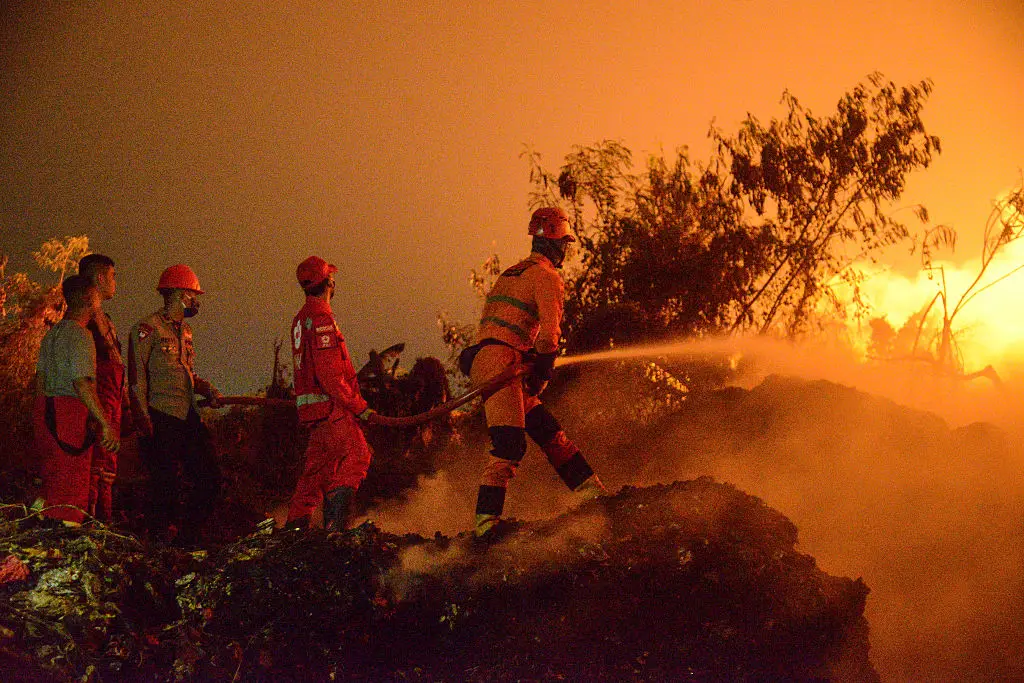
The Copernicus Atmosphere Monitoring Service (CAMS) has warned that the impacts are already taking their toll on dry land as conditions are making devastating wildfires in Indonesia even worse.
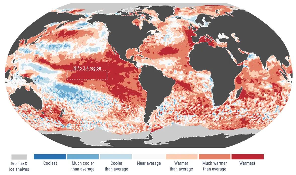
They've also warned that temperatures at the poles are the highest they've ever been, as the average sea surface temperature in August was 21.07°C, a new record for the hottest polar seas in August.
It was also the joint-highest it's been for all recorded months, being tied with March 2024 for when the water temperature in the oceans around the polar icecaps was hottest.
Copernicus warned of several other signs of the coming El Niño and how the world's weather was already suffering from the extreme conditions, as major droughts across certain parts of Europe and flooding in others over the summer have both been warning signs.
Wherever the weather is going, the El Niño risks making it more extreme so a hot summer can trigger drought and wildfires, while countries with wetter conditions are now facing increased flood risk.
Many other parts of the world including the southern USA and the north of Mexico, much of Asia, South America and South Africa were drier than usual, while other regions like the eastern USA, Japan, the north of India and Chile were wetter than average.
Matthew Cappucci, senior meteorologist at MyRadar, told LADbible that 'much like with any type of weather, there will be winners and there will be losers'.
"I think the key thing is that because the El Niño is so strong, the type of weather it produces will be a little bit more extreme than normal.
"So like with the Pacific, a more extreme hurricane season, or with the Atlantic, a more extremely quiet hurricane season."
The meteorologist said the Pacific would be the main 'losers' from the El Niño and the parts of the world that most felt the impacts would suffer greatly.
He suggested that what people would most notice from the El Niño was 'an extremifying of both drought and flooding'.
"Areas that get heavy rainfall are going to, in some cases, get more. Other places will see a significant drought," he explained.
With weather expected to get more extreme, Cappucci warned that since 'we build our infrastructure to what's most common for us' a change or intensification in weather patterns risked subjecting an area to conditions the infrastructure wasn't ready for.
He said: "If you have something like an El Niño that changes weather patterns, whether it's good or bad or stormy or not, that adaptation is going to be tough for people."
While Copernicus notes that this year has had the hottest month on record with high oceanic temperatures, the El Niño won't restrict itself to impacting this year as 2027 is predicted to be the hottest year on record due in part to the major weather event.
If you're looking at the high temperatures this year and seeing the destructive impact of more extreme weather then buckle up for another year of warnings and danger.
August 2026 may have been the hottest month on record but that could well be supplanted by this time next year, with all the consequences that entails.
Topics: World News, El Niño, Weather
 Joe Harker