New predictions made for ‘Super El Niño’ that will have brutal consequences on entire world
The latest predictions for this year's Super El Niño make for grim reading, according to experts.
Shocking new statistics appear to show that 2026 will see the 'strongest' El Niño ever recorded, with sea temperatures set to rise by a worrying 4 degrees above average.
That's according to the latest modelling from the European Centre for Medium–Range Weather Forecasts (known as the ECMWF), reports the Daily Mail.
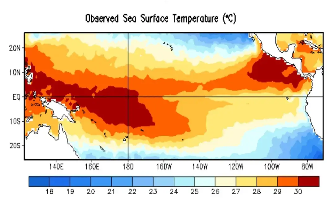
To work out how impactful an El Niño will be, scientists use something called the Niño 3.4 index.
Advert
As well as resulting in extreme weather conditions, it can also have an impact on the cost of food as crops get wiped out by droughts and flooding.
This index keeps a track of anomalies in the sea surface temperature.
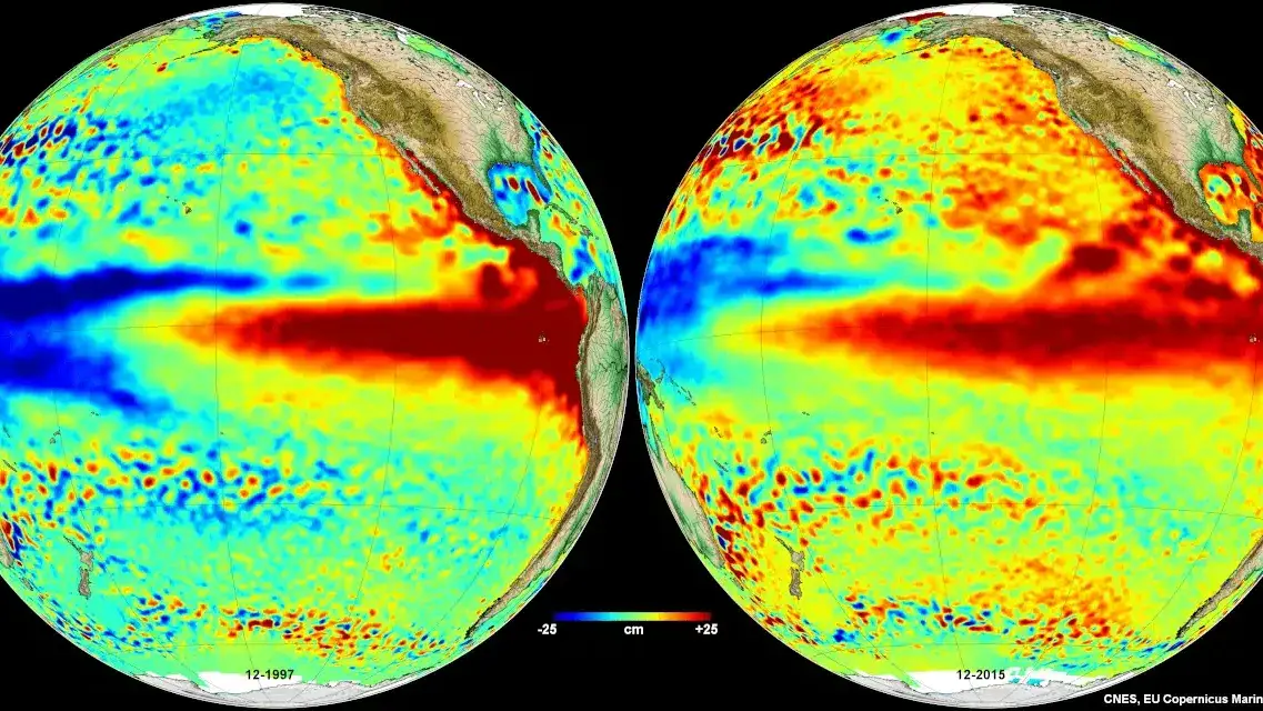
In the past, the the two strongest ever El Niño years were in 2015 to 2016 and 1997 to 1998.

Those years saw the Niño 3.4 index increasing by 2.3°C, but the predictions for 2026 far surpass that.
Scientists have found that in almost every possible scenario they have tested, the equatorial Pacific Ocean temperature is set to increase by 3°C at the very least.
Some simulations have forecast an even scarier 4°C rise.
What is a Super El Niño?
Met Office spokesperson Nicky Maxey previously told LADbible: "A 'super' El Niño is not an official scientific category, but it is a term sometimes used in the media to describe a particularly strong El Niño event,"
"There are increasing signals that El Niño is developing in the tropical Pacific. The tropical Pacific El Niño region is predicted to warm faster this year than any time so far this century, with sea‑surface temperature anomalies exceeding 2C in the central and eastern tropical Pacific, which would be notable by historical standards.
"While there is the potential for it to become a stronger event, it is still too early to determine exactly how strong it will be or what the precise impacts might be."
Record rises
Ben Noll is a meteorologist and global weather writer, and he wrote on X: "Almost every scenario now reaches past +3˚C, with a cluster of high–end scenarios in excess of +4˚C. This outlook now depicts the strongest El Niño on record."
This is all part of a cycle called the El Niño–Southern Oscillation, which sees the weather shift between hot and cool phases every two to seven years.
During the heat phase, the warmer the oceans become means we have hotter temperatures and more extreme weather periods.
2024 was the hottest year on record so far thanks to one of these cycles, but scientists are now predicting 2026 will be the hottest year ever.
Experts are now warning of extreme heat 'nearly everywhere' this summer.
NASA researchers shared that their latest satellite data revealed that a swell of warm water which spans some hundreds of miles wide has already arrived in the Pacific Ocean, and say that this is tusually a sign that an El Niño event is about to begin, based on past data.
NASA said: "Waves of higher, warmer water move eastward across the Pacific Ocean a few months before an El Niño emerges. Several have shown up in 2026 satellite data."
Super El Niño events often result in massively increased rainfall in parts of southern South America, southern areas of the United States, parts of Africa and central Asia, leading to widespread flooding.
However, it also causes much drier, hotter conditions in Central America, northern South America, the Caribbean, Australia, Indonesia, and parts of southern Asia, which can cause droughts and wildfires.
Topics: Weather, NASA, Science, World News