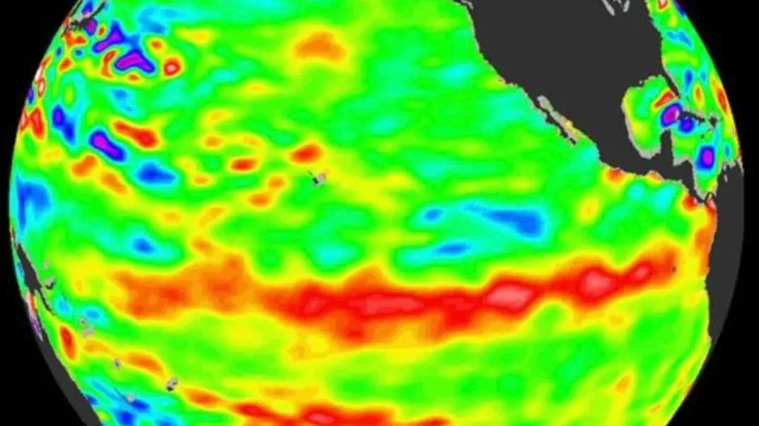
When Super El Niño will peak as NASA release new images of weather phenomenon

The Super El Niño is set to wreak havoc on the world's weather - and scientists reckon they have an idea of when it will reach its peak.
The climate of our planet is set to be impacted significantly by the phenomenon, which 'influences weather patterns across large parts of the globe as well as global temperature', the Met Office explains.
It involves a 'sustained period of warmer‑than‑average sea surface temperatures across the central and eastern equatorial Pacific Ocean'. Experts add that 'stronger events tend to have more widespread and pronounced global effects'.
The latter is what is known as a Super El Niño, although this is not an official scientific categorisation.
Advert
However, it is a term often used in the media to 'describe a particularly strong El Niño event', Met Office spokesperson Nicky Maxey told LADbible.
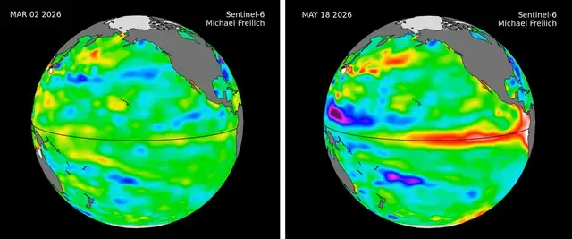
"There are increasing signals that El Niño is developing in the tropical Pacific," Maxey said. "The tropical Pacific El Niño region is predicted to warm faster this year than any time so far this century, with sea‑surface temperature anomalies exceeding 2C in the central and eastern tropical Pacific, which would be notable by historical standards.
"While there is the potential for it to become a stronger event, it is still too early to determine exactly how strong it will be or what the precise impacts might be."
Experts say Super El Niño events can trigger:
- Extreme global heat
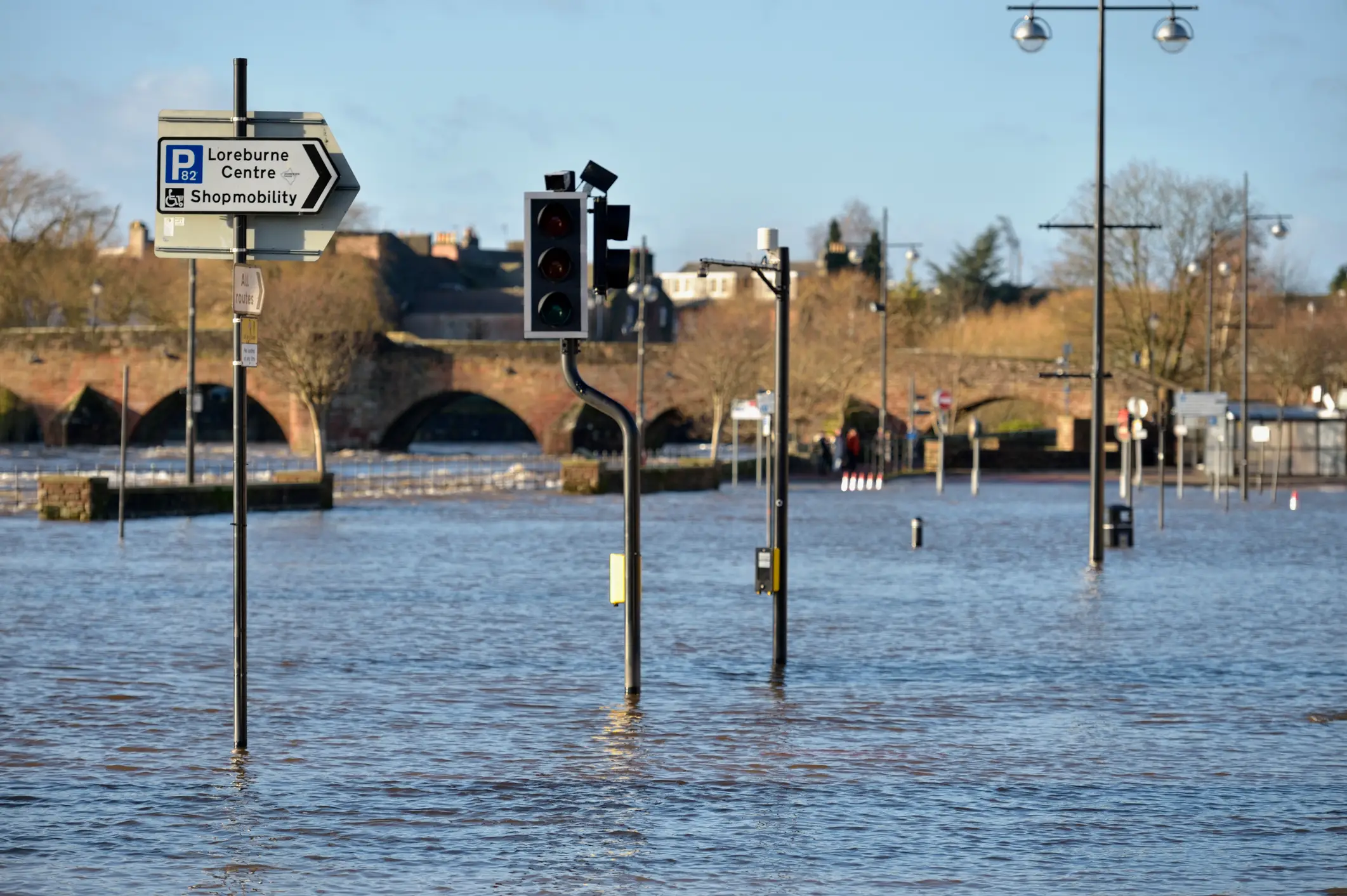
- Flooding in some regions
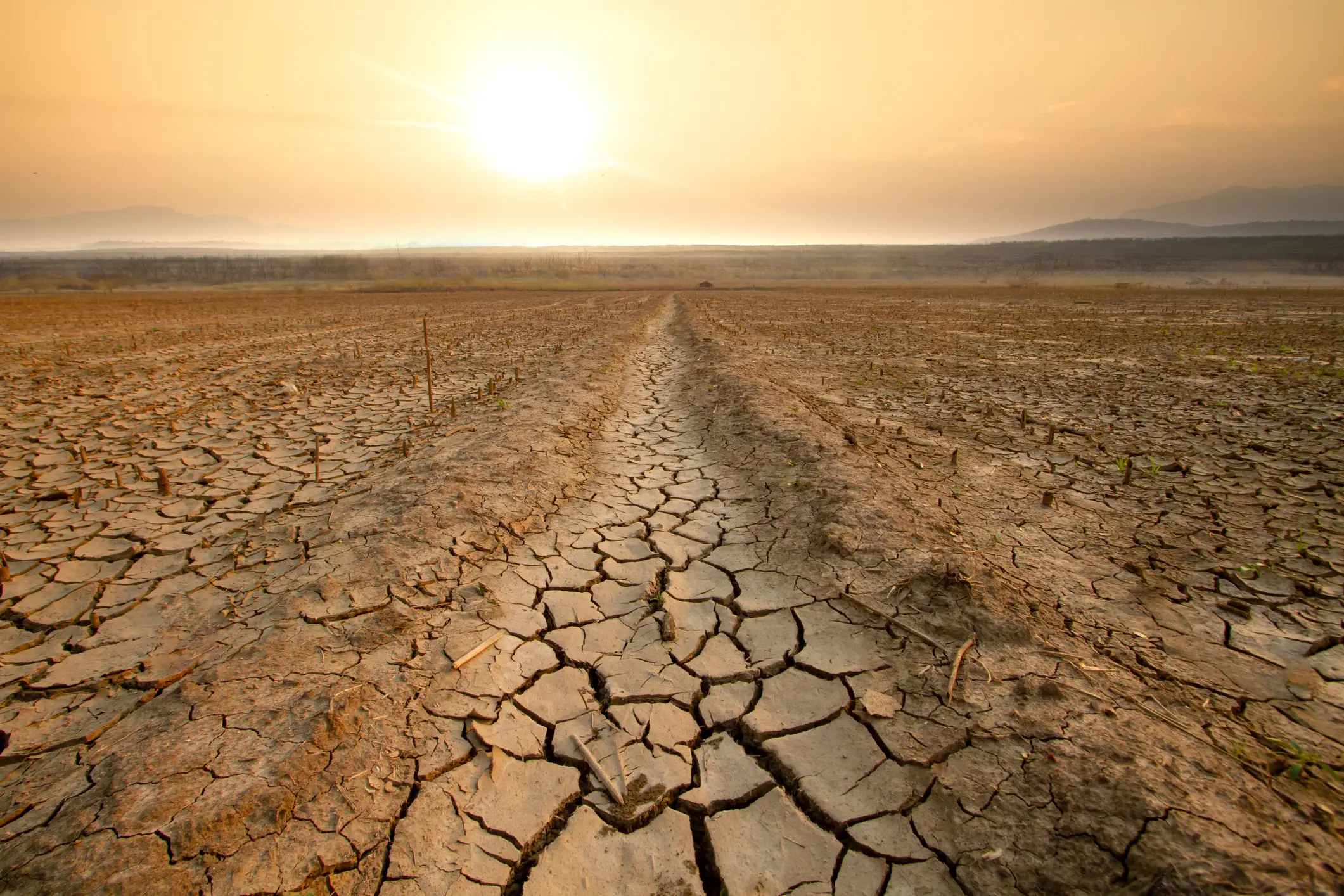
- Droughts and wildfires in others
- Crop failures and food shortages
- Coral bleaching and damage to fisheries
It’s thought that it will be upon us later in the year, potentially causing heavy precipitation in some regions but deficits in others.
When is the Super El Niño expected to peak?
According to the World Meteorological Organization (WMO), 'the most pronounced impacts are in the year following development', which would push the worst of the current El Niño's effects into 2027.
The picture is complicated as it tends to affect different parts of the world at different times and in different ways depending on local seasonal cycles.
In China, the country's Climate Centre's deputy director Gao Rong explained that sea surface temperatures close to the equator and in the eastern Pacific have entered an El Niño state, which will progress in summer and autumn, to a moderate or higher intensity El Niño.
Then, in the latter stages of autumn and the beginning of winter, he expects that it will reach its peak.
Rong told reporters, as per Reuters: "The probability of strong El Niño events is increasing, and it is expected to weaken next spring."
But Mark Maslin, a professor of earth system science at University College London, said the UK could face the worst of the El Niño's effects next summer after things start to kick off in autumn this year.
He told The Times: "Any especially hot weather we have this summer will be just normal climate change. El Niño will really start to bite in the autumn.
"We could see a return of record-breaking 40℃ weather next summer.”
The BBC adds that the effects of an El Niño on the UK tend to lag behind the actual event, and can be more pronounced in the later winter months.
The 2015/2016 El Niño led to 2016 being the warmest year on record at the time, but also caused devastating floods in the UK in December 2015.
The climate phenomenon is also expected to bring about unbearably cold winters too, so the impact of a Super El Niño seemingly swings from one extreme to the other.
NASA just dropped new images of the sea level data it has acquired ahead of the El Niño emerging.
How does an El Niño year happen?
Strap in, folks. It’s time for some science.
It all starts with something called trade winds, which are permanent winds around the equator which usually blow from east to west. So in the equatorial Pacific, they blow from the Americas towards Australia and New Zealand.
As the wind blows the water east, it is warmed by the sun, so by the time it gets to the other side of the Pacific, the warm water causes hot air to rise, leading to warm, wet and unsettled weather. Meanwhile, colder water from deeper in the ocean rises in the east to replace the water blown west.
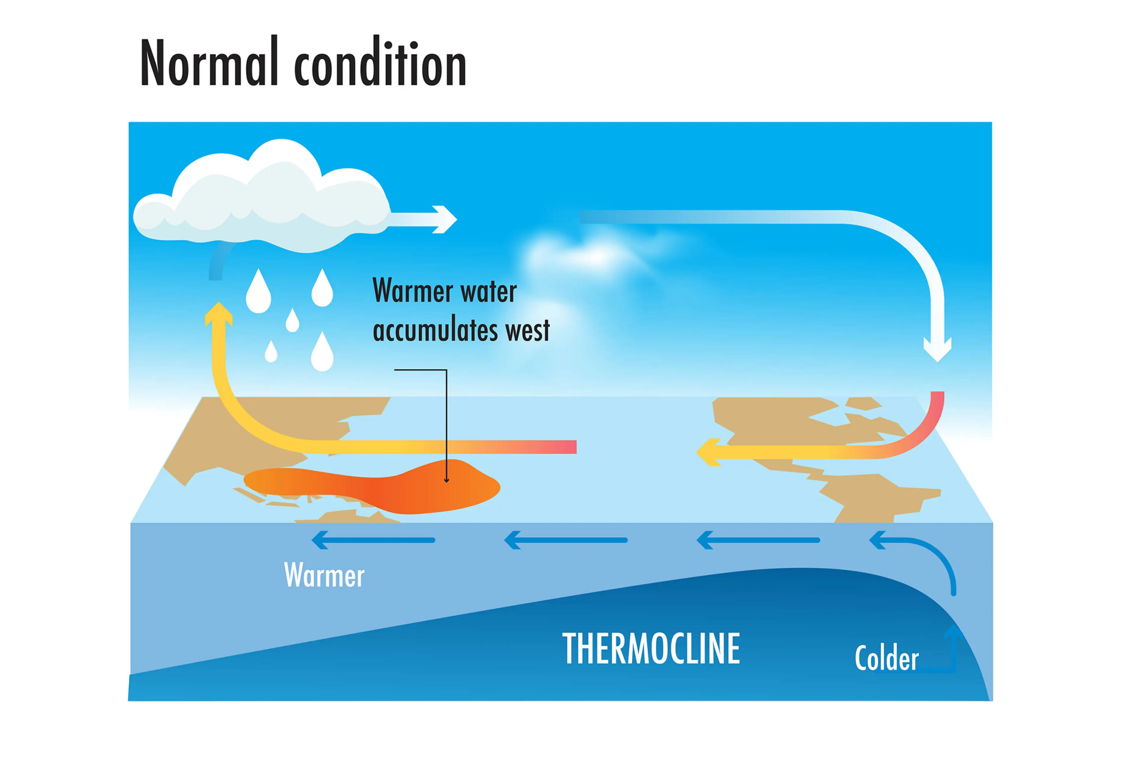
But during El Niño years, this gets disrupted.
When trade winds are weakened or even reversed, the temperature difference between the east and west is cancelled out, and usually cold parts of the ocean warm up.
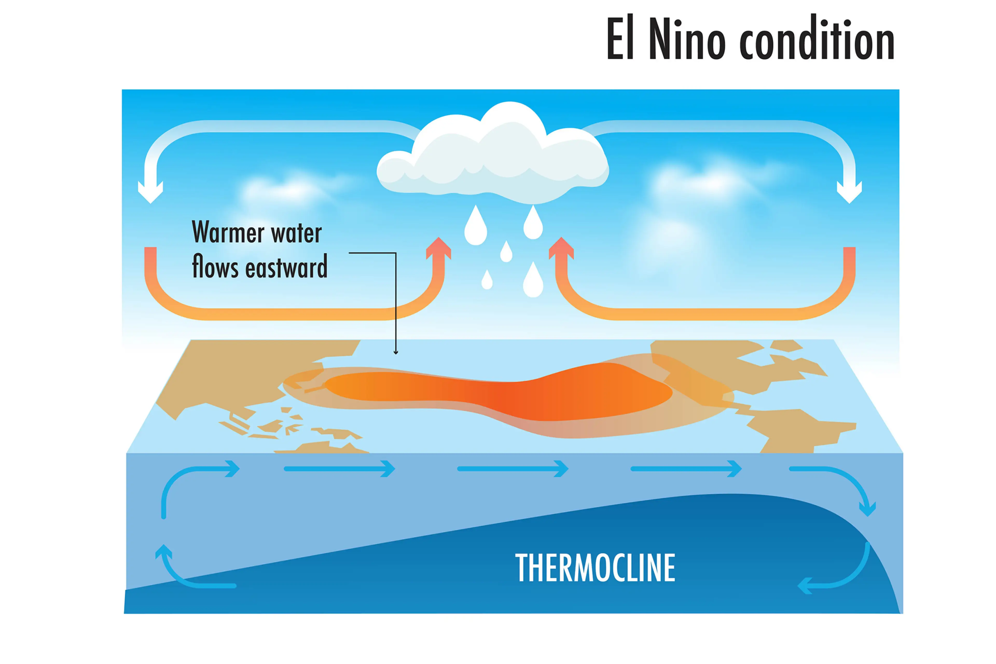
Rainfall and wind patterns change across the equatorial Pacific, which has a knock-on effect around the world.
Anyone else's head hurt a bit?
 Olivia Burke