NASA releases new images of 'Super El Niño' that will bring catastrophic global consequences

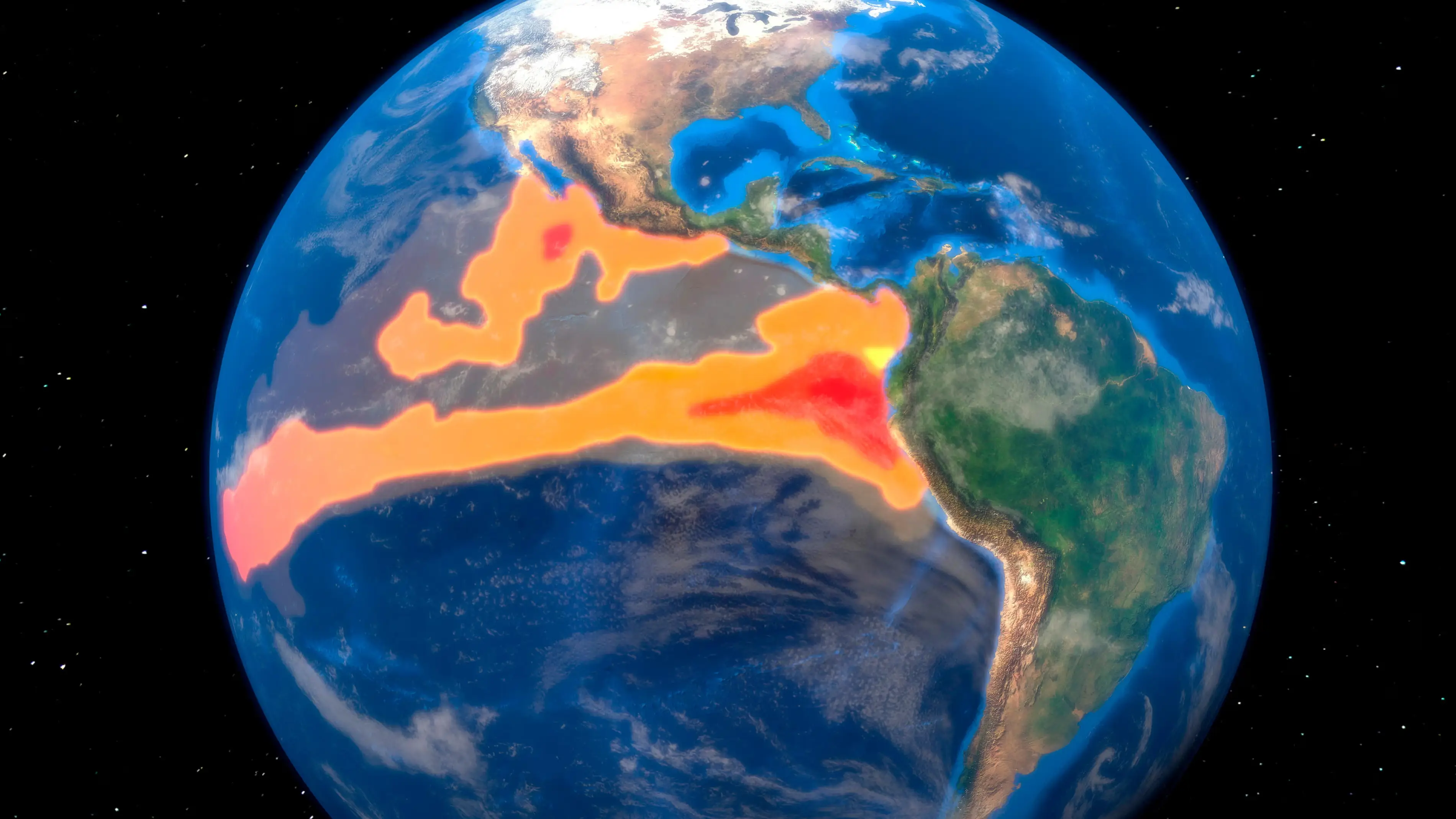
It’s thought that next year could be the warmest on record as a ‘Super El Niño’ is set to emerge.
The natural climate phenomenon occurs when there is a sustained period of warmer-than-average sea surface temperatures across the central and eastern equatorial Pacific Ocean.
This upcoming one might lead to severe weather conditions as well as food shortages and major humanitarian problems globally.
Advert
And as these waves of higher, warmer water move eastwards across the Pacific, NASA has captured images of the sea level data ahead of the El Niño emerging.
It’s thought that it will be upon us later in the year, potentially causing heavy precipitation in some regions but deficits in others. It’s warned that this will influence daily life and commerce around the world.
Several of these waves of higher, warmer water have shown up in 2026 satellite data, showing a swell of warm water hundreds of miles wide has arrived in the Pacific off the coast of South America.
NASA explains that as water expands when it warms up, a rise in ‘elevation of an area of the ocean indicates increasing ocean temperatures’.
The Sentinel-6 Michael Freilich satellite was launched by the space agency in 2020 and led by ESA (European Space Agency) for the E.U. Copernicus Programme.
It measures and maps water height for the entire ocean every 10 days down to fractions of an inch.
In the case of the infamous El Niño, the satellite tracks what are referred to as warm Kelvin waves.
“These waves typically form after brief periods when winds over the far western equatorial Pacific Ocean shift from prevailing easterlies — moving from east to west — to westerlies,” NASA explains. “That effect, combined with a general weakening of easterly winds along the equator, causes water in the tropics of the western Pacific to get warmer and sea levels to rise.”
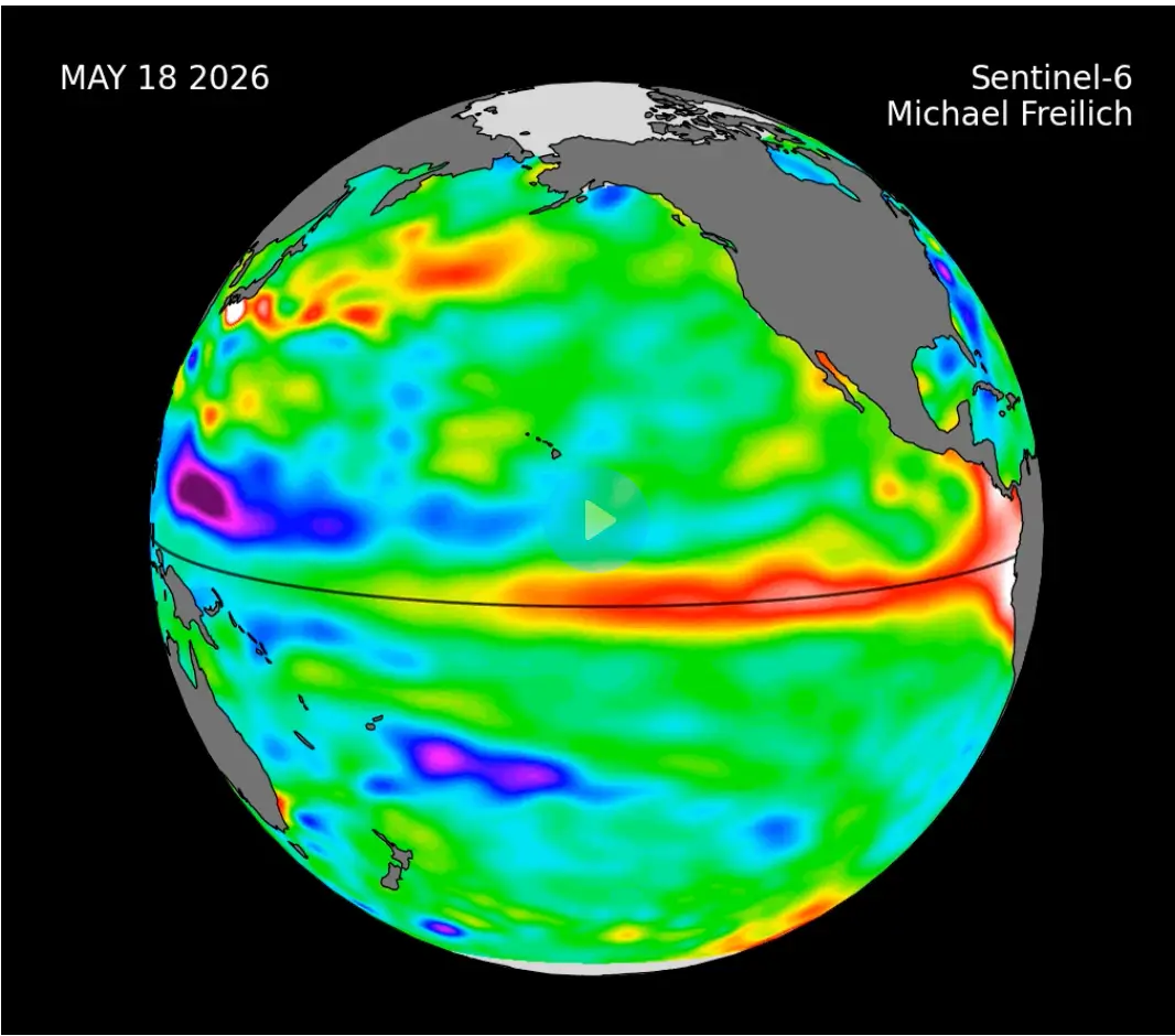
Sea level researcher and project scientist for Sentinel-6 Michael Freilich Josh Willis said: “While this year’s event started a bit later than the big El Niños of 2015 and 1997, it’s beginning to catch up. We’ll see how big it gets.”
The strongest El Niño so far was that one in the 90s, which is said to have killed 23,000 people and caused between £21-28 billion in damage.
The weather phenomenon resulted in floods, cyclones, droughts and wildfires.
Back in December 2015, we saw some of the worst flooding the UK has ever experienced and this was also linked to El Niño.
How does an El Niño year happen?
Strap in, folks. It’s time for some science.
It all starts with something called trade winds, which are permanent winds around the equator which usually blow from east to west. So in the equatorial Pacific, they blow from the Americas towards Australia and New Zealand.
As the wind blows the water east, it is warmed by the sun, so by the time it gets to the other side of the Pacific, the warm water causes hot air to rise, leading to warm, wet and unsettled weather. Meanwhile, colder water from deeper in the ocean rises in the east to replace the water blown west.
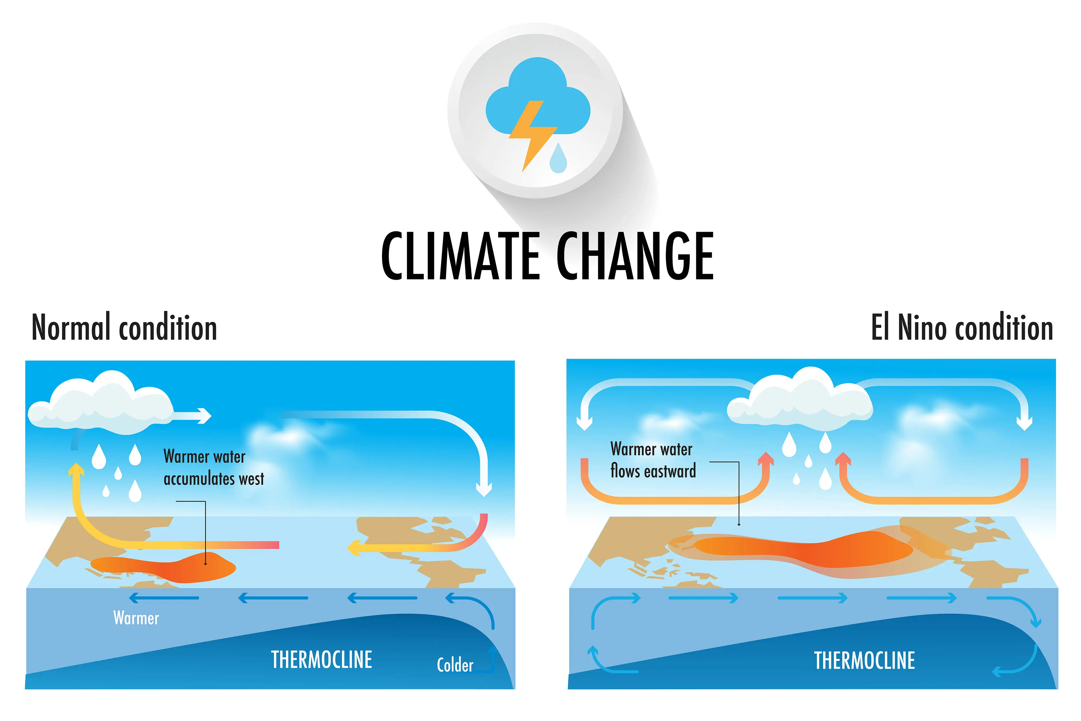
But during El Niño years, this gets disrupted.
When trade winds are weakened or even reversed, the temperature difference between the east and west is cancelled out, and usually cold parts of the ocean warm up.
Rainfall and wind patterns change across the equatorial Pacific, which has a knock-on effect around the world.
Anyone else's head hurt a bit?
Topics: Global Warming, NASA, Science, Weather, El Niño
 Jess Battison