Warning issued about ‘terrifying implication’ of Super El Niño no one talks about
If there wasn't already enough to be worried about in the world, experts are warning about the potentially catastrophic 'Super El Nino' weather event.
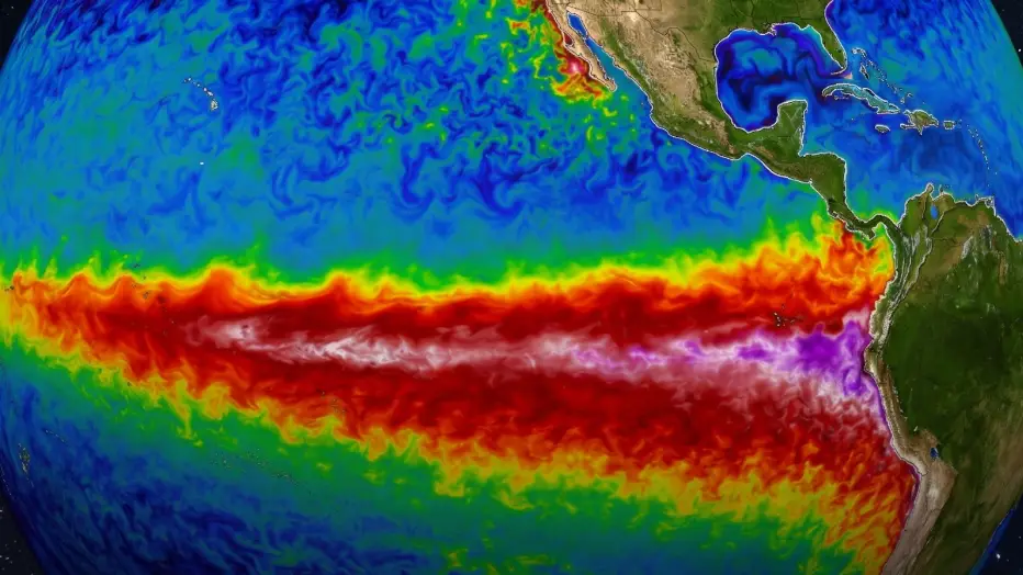
The phenomenon is currently forming in the Pacific Ocean and is threatening to cause a huge number of fatalities and financial ruin if it follows in the footsteps of previous El Nino events.
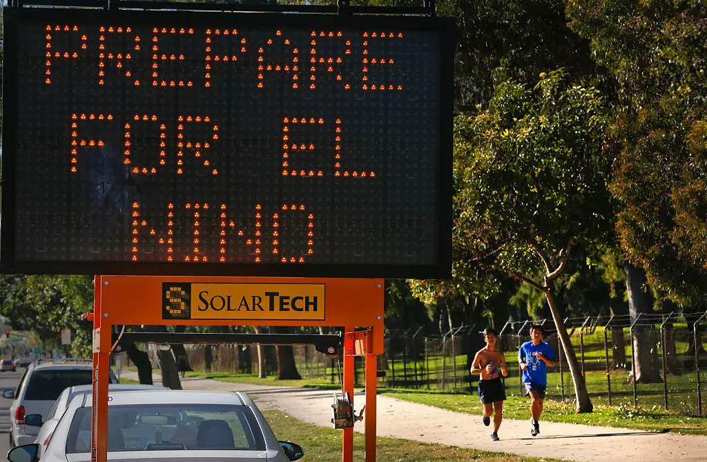
While people living in the UK might not be too concerned about the threat of the warmest year on record, there are also likely to be some colder temperatures in the winter months.
Outside the UK however, there could be some extreme weather conditions including floods, cyclones, droughts and wildfires, but it seems as if weather isn't the only thing that the world's population should be concerned about when the Super El Nino officially arrives.
Advert
YouTuber 'The Sky Lab', has now talked through some of the more terrifying implications that could arrive from the ever-growing weather phenomenon, which has the potential to be the most powerful on record.
He says: "The triple whammy, the three oceans pulling together. The mechanism itself is a single trans-pacific circulation pattern with its fingers in four corners of an ocean plus a jet stream that can lock into wave patterns that park drought on linked regions at once.
"The global food system, its insurance, its reserves, its trade models is built on the assumption that this mechanism does not exist.
"And 2026 is walking into the event with the bread baskets already stressed, the granaries already drawing down and the planet already at record heat.
"That is the implication. That is the terrifying implication no one talks about. Not that El Nino is coming. Everyone is saying that.
"The implication is that the world built its food security as though the one force that can break it does not exist."
The strongest El Niño so far took place in 1997-1998. According to The Guardian, it killed 23,000 people and caused £21 billion to £28 billion in damage.
But this particular event could be in the 99th percentile and now looks almost certain to happen, according to Paul Roundy, a professor of atmospheric science at the University at Albany.
He said: “The warm water to the east of this year’s westerly wind burst is about half a degree warmer than the warm water was at the same time in 1997,” Roundy said. “It has basically been hit with all the momentum that is needed to bring the event over the intensity of what was achieved then.
"Based on the distributions of historical surges in the trade winds and the distribution of westerly wind events, and how strong the recent event has been, it would take an event well beyond the 99th percentile in intense trade winds to render the developing El Niño event just strong and not extremely strong.”
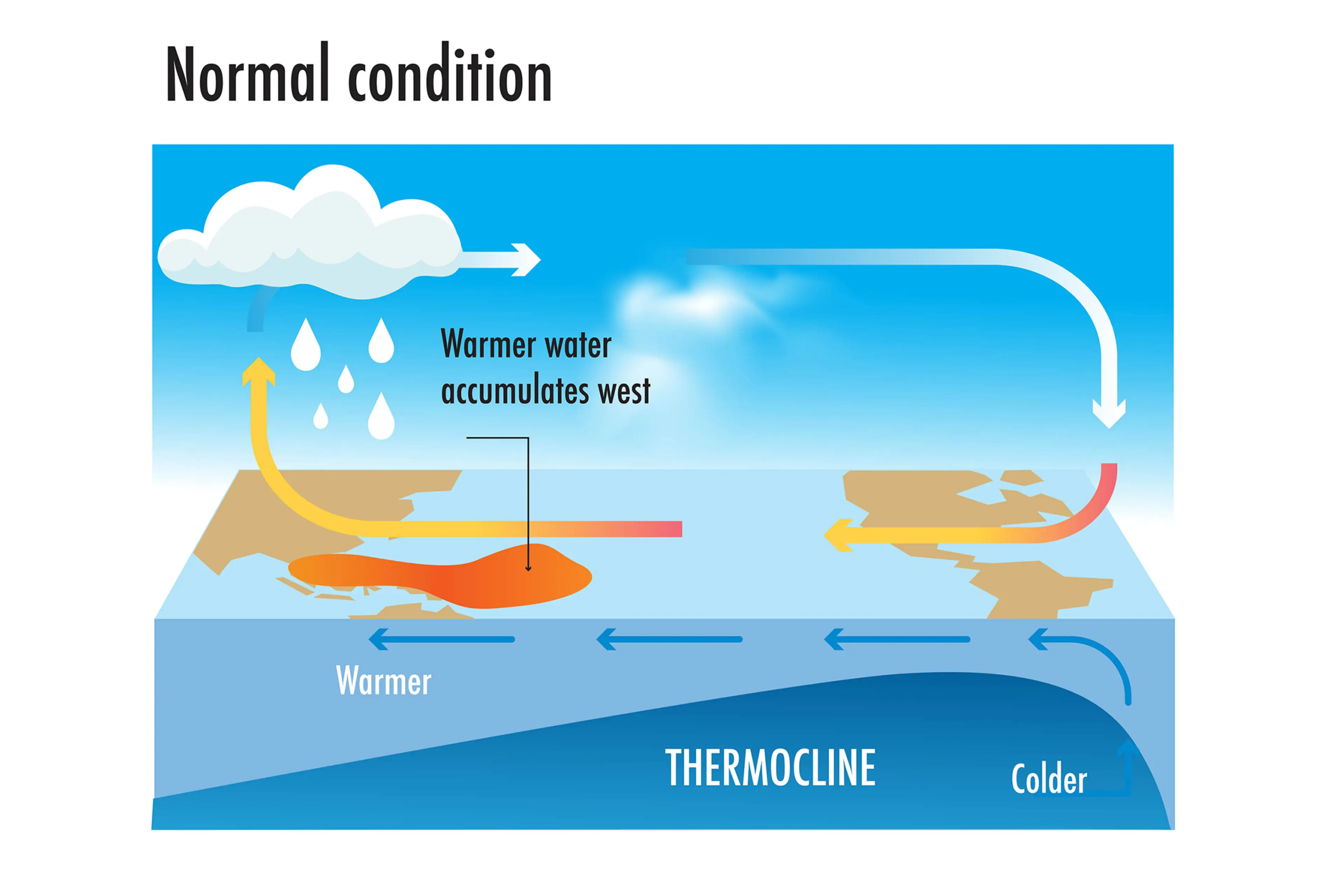
How does an El Niño year happen?
Strap in, folks. It’s time for some science.
It all starts with something called trade winds, which are permanent winds around the equator which usually blow from east to west. So in the equatorial Pacific, they blow from the Americas towards Australia and New Zealand.
As the wind blows the water east, it is warmed by the sun, so by the time it gets to the other side of the Pacific, the warm water causes hot air to rise, leading to warm, wet and unsettled weather. Meanwhile, colder water from deeper in the ocean rises in the east to replace the water blown west.
But during El Niño years, this gets disrupted.
When trade winds are weakened or even reversed, the temperature difference between the east and west is cancelled out, and usually cold parts of the ocean warm up.
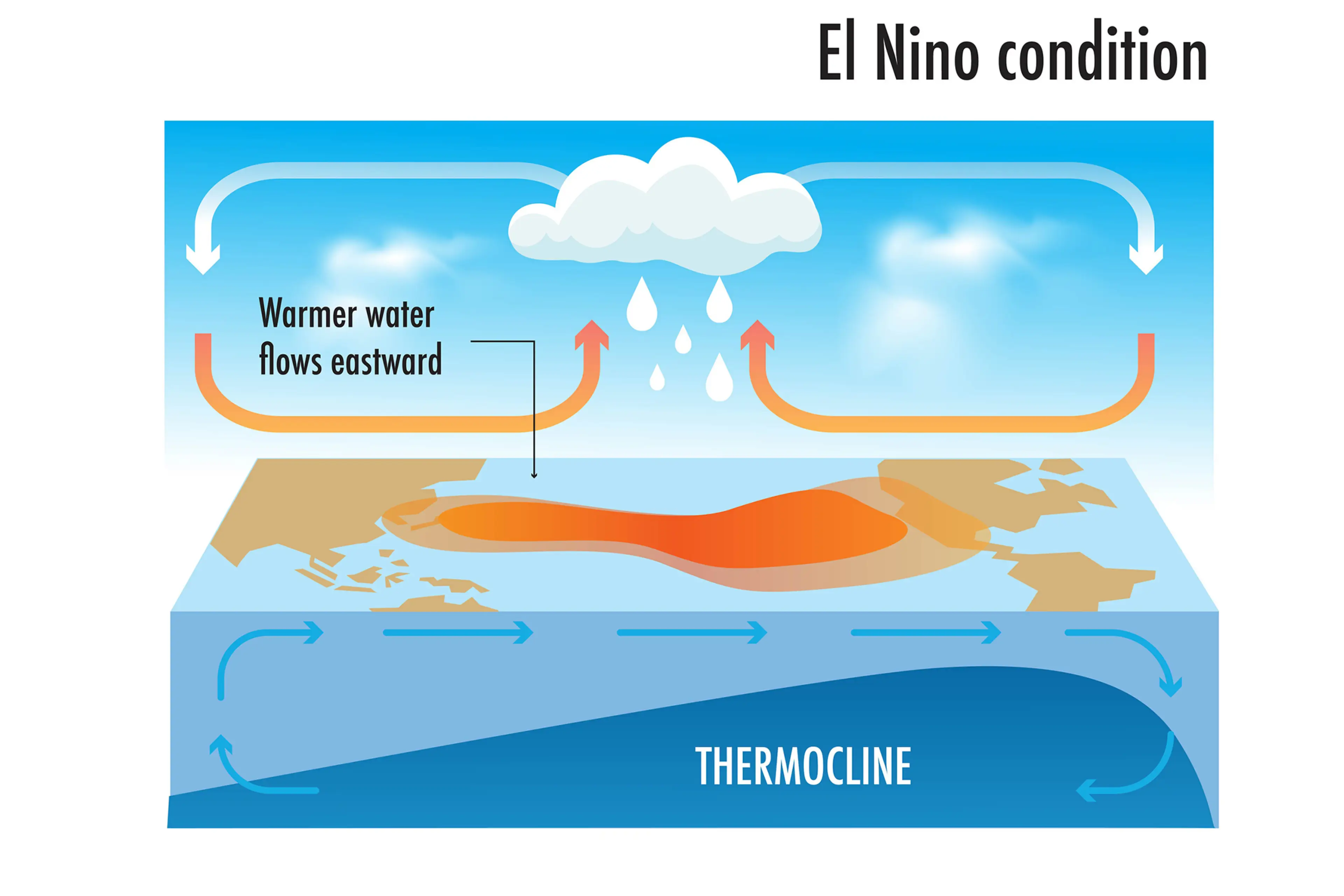
Rainfall and wind patterns change across the equatorial Pacific, which has a knock-on effect around the world.
Anyone else's head hurt a bit?
Topics: Environment, Science, UK News, Weather, El Niño
 James Moorhouse