Arctic Blast to grip the UK within the next 24 hours
If you haven't dusted off the winter coat yet, you probably will do very soon as an Arctic Blast is set to grip the UK within the next 24 hours.
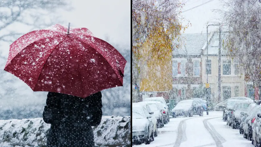
Long Johns season is upon us as the Met Office has warned that parts of Britain will be hit with sleet and snow - with Saturday being expected to be the coldest night of the year so far, with first sub-zero temperatures.
A Met Office spokesman said the cold and variable weather is to be expected at this time of year, though the UK has historically had the first frosts in October.
Advert
He said: “We can see there’s big swings in temperatures, all it takes is a quick change from a southern wind into a north wind to have that change.
“It’s not unusual to see these changes.”
Sleet and snow may fall in the north of Scotland and on peaks above 400 metres (1,312ft) high, the national weather service said.

"By the end of the week we are going to see cold winds arrive from the north," Met Office meteorologist Aidan McGivern explained.
"It's going to feel colder this week and there will be some snow showers over, mainly, hills of northern Scotland.
"But elsewhere, with high pressure in place, it is going to be mostly dry on Friday and into the start of the weekend."
Meteorologists believe that night will see thermometers hitting minus 4C in Wales and minus 5C in the rural South West.
Daytime temperatures are not expected to reach double digits during the day on Saturday but will be returning to above 10C by Sunday and into the following week.
Sky News weather producer Chris England said we can expect the Arctic air to spread over most of the UK within the next couple of days.
We should expect 'very strong winds and a scattering of hail and snow showers to the north and east'.

He added: "High pressure following from the west will settle things down later on Friday, with an extensive frost developing overnight.
"Temperatures will mostly be a degree or two (Celsius) above or below freezing, but some sheltered northern parts may well go a few degrees lower."
The UK will also be faced with 'Nagging wind', which will be hitting the north-east and are forecasted to cause high waves and pose challenges to lorries over the weekend.
The strong winds are also affecting the east of the country down to Norfolk, but are calmer in more southernly regions.